Preface
In the summer of 2013 I realized a lifelong dream. I hiked the John Muir Trail in California’s Sierra Nevada range. I didn’t necessarily want to walk alone but finding companions was all but impossible. So out of frustration, I did it solo. Not that I was uncomfortable hiking alone, I had done many backpacks by myself. And now in retrospect, I’m glad I did. Hiking in the magnificent Sierra Nevada for five weeks was truly a transcendental experience. It was almost Zen-like. There was no one to talk to, only the inner dialogue with yourself, the mindless nonsense of everyday life falling away with every step. Life was reduced to the bare essentials: stay warm, walk, eat, and sleep. It was a minimalist experience. As a backpacker for more than fifty years, I was not expecting anything different on this walk. But I was wrong. The extended length of the trip, the stunning beauty of the mountains, and five weeks of solitude made this adventure one of insight and inspiration. I will never forget it.
I hope you enjoy the trip.
Chapter 1-False Start
“Oh hell, they’re not here!” I yelled.
I furiously rummaged through my duffel bag in a panic, looking for my missing orthotic boot inserts. Without these little gems I was going absolutely nowhere. How could I be so stupid? I had fastidiously planned out every aspect and detail of my five week trip. Every meal, every cache point, every reservation, every campsite. I had made resort reservations a full nine months in advance to insure availability. I had sent my food caches to the appropriate places almost four months ago. I had arranged for my daughter Kate and her boyfriend Jonathan to deliver me to the trailhead a day ahead of time in order to acclimate to the high altitude. I had thought of everything. After all, I had been planning this for a full year. It was slated to be the trip of a lifetime, but not now!
“You moron!” I railed.
I threw up my hands in complete frustration as everyone stood in stunned surprise at my outburst. Only Grandpa showed no concern, largely because he couldn’t hear me. At 97 he had serious hearing loss and refused to wear a hearing aid. And he still drove his aging Ford Crown Victoria! Kate and Jonathan were immediately alarmed. They both knew how much this trip meant to me and how long I had been waiting to step onto the John Muir Trail.
“What? What are you talking about?” Kate exclaimed with dismay.
I simply could not believe that I would have done something so neglectful. I went through the duffel two more times just to satisfy my racing mind that I was not imagining this. For humans with normal feet, foot orthotics are generally not a concern. But after years of wearing flat sandals in the Southern California heat, I had damaged my feet to the point where I simply could not go without orthotics. At age 64, wearing sandals, or anything without support, would cause my feet to burn and go numb. Needless to say, to attempt to hike 230 miles would be unthinkable. A profound depression settled upon me as I collapsed onto the sofa, finally realizing I had left those miserable pieces of shit back in Los Angeles.
“My orthotics,” I squeaked.
Kate instantly knew the significance of this blunder, her face now suddenly more somber. Jonathan looked on in confusion, not knowing my history of foot trouble.
“Oh no,” Kate replied.
We were in Bakersfield visiting Grandpa on our way to the trailhead at Horseshoe Meadow just outside of Lone Pine in the Eastern Sierra. Blissfully unaware of my dilemma, Grandpa continued to read the Bakersfield Californian while Kate and I stared at each other, wondering what to do.
“I know where they are. I left them in my other shoes at home,” I stammered in absolute frustration.
“You can’t walk anywhere without those,” Kate reminded me.
“No shit, Sherlock,” I responded.
Thankfully Jonathan was far more clear-minded than either Kate or me. We were planning to stay the night in Bakersfield, then drive to Horseshoe Meadow the following day to acclimate for a day on Wednesday August 14th, 2013. The next day, Thursday, I would begin my epic solo backpack. At least, that was the plan. Now I was completely catatonic and at a loss as how to proceed. Kate was no better.
Finally, Jonathan had the presence of mind to say, “Hey, this is not a problem. Get Cindy to overnight them to Lone Pine. They can be here on Wednesday.”
Ah, thank heavens for cooler heads. I had been so freaked out by my own idiocy that I was unable to formulate a solution. Of course, I thought, there is still time. It was only Tuesday and was starting my hike on Thursday morning. No problem, or so I thought.
“Great idea! That should do it and not delay my start time either,” I said enthusiastically.
I seized my cell phone and dialed Cindy. It was shortly before noon and she was just starting her lunch at Collegewood Elementary where she taught kindergarten. She picked up, to my great relief.
“Cindy, I’ve done something mondo stupid. I left my orthotics in my other shoes!” I blurted.
“You goof!” she replied good-naturedly .
“Could you overnight them to Lone Pine?”
“Sure. I’ll do it now during my lunch. Are you sure they’re in your other shoes?”
“Yes. So sorry about the trouble. You’re the best wife.”
“I’ll call when I get them to UPS. Shouldn’t take long.”
“Oh thank you, thank you, thank you!”
I hung up with a sigh of relief. I was going to be saved after all, or so I thought. Again. After about an hour Cindy called back. Things were not going well.
“Hi sweetheart,” I answered. “How did it go?”
“Well, UPS can’t get it to Lone Pine overnight since it is such an out-of-the-way little town.”
“What?”
I was back in panic mode. I hadn’t thought of the fact that Lone Pine is a mere blip on the radar. My hike was going up in smoke again.
“But Fed Ex thinks they can.”
“Oh great!” I exclaimed in relief.
“Well, don’t get too excited. They said they couldn’t get it to Lone Pine by Wednesday since it is too late today. And they weren’t even sure about Thursday!”
“Oh no.”
Back into panic mode.
“You’ll just have to wait until then and hope for the best,” Cindy replied.
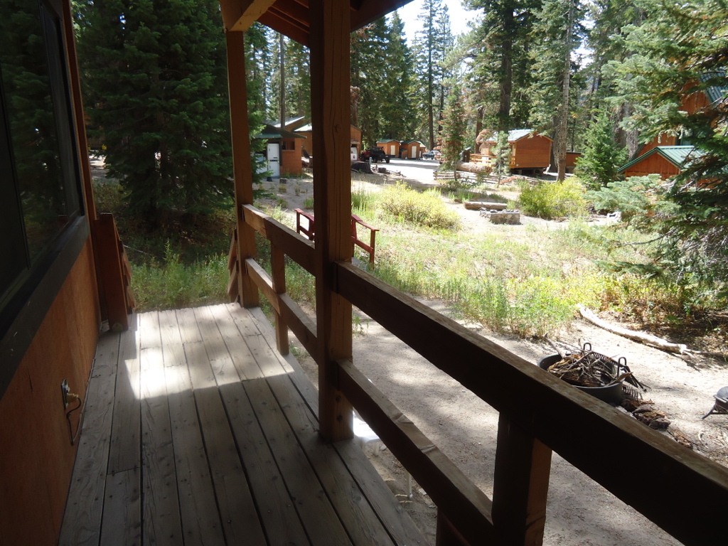
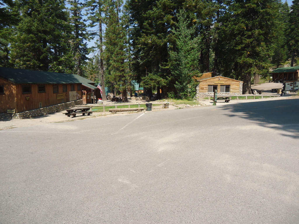
And that is precisely what we did upon our arrival in Lone Pine. After saying goodbye to Grandpa and scenic Bakersfield on Wednesday morning, we arrived in Lone Pine in time for lunch. Kate and Jonathan preferred not to camp and checked into the Dow Villa Motel where my package containing my miserable orthotics would hopefully arrive. We all had lunch at the Mt. Whitney cafe where I scarfed down a sizable order of onion rings. Kind of a dying man’s last request. Bad idea. As a devoted vegetarian for thirty-five years, I generally avoided processed foods and deep-fried anything. I figured I would burn all those calories off in a flash once I hit the trail. Without thinking anything about it, I finished off my salt, batter, and grease heavy lunch. Jonathan and Kate drove me to the trailhead at 10,000 feet where I pitched my tent and we took a delightful walk around the meadows, despite my aching feet. After two years of drought the meadow was tinder dry with hardly a wildflower to be seen. We said goodbye as they headed back to town while I settled into a serious nap. That’s when it hit me. Not accustomed to fast food, my digestive system went into warp drive. Let’s just say that it was a good thing I was close to the campground pit toilet. Good thing this didn’t happen on the trail, I would have blown through every ounce of toilet paper I carried. One can only imagine the backcountry consequences!
“Oh great, this trip is starting off with one calamity after another,” I said to myself.
Later that day about 6PM Kate and Jonathan came back up the hill to join me for dinner. Of course, I hoped that the package might have arrived but it didn’t. I had recovered substantially from my fast food freak out by dinner and we enjoyed a delightful meal in the sublime wilderness of the Sierra Nevada. Still, I was troubled by what course of action I would take if the orthotics did not materialize. If they arrived on Thursday, it would probably be in the afternoon but I could still get on the trail and make it to Chicken Spring Lake by nightfall.
If they arrived on Friday, my entire schedule would be thrown off by one day. I would have to make up the mileage by hiking extra miles everyday, otherwise I would miss my food cache and resort reservations further down the trail. I would be starting a 230 mile hike with a mileage deficit, less than happy digestive tract, a pulmonary system not yet entirely acclimated to higher elevation, and feet not used to walking six hours a day. Two of these were unavoidable but the other two were of my own stupidity.
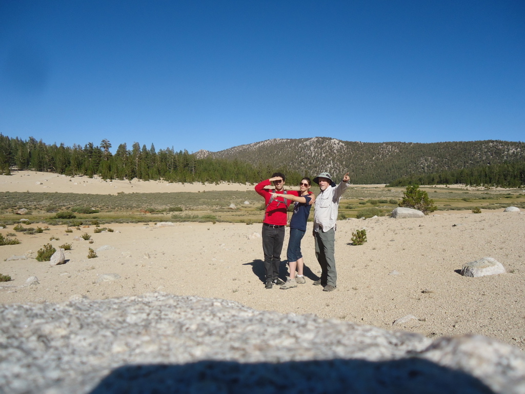
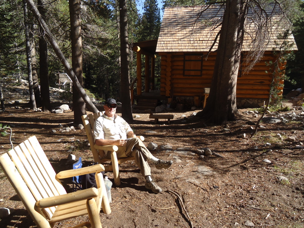
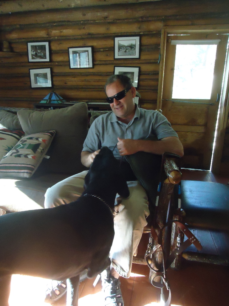
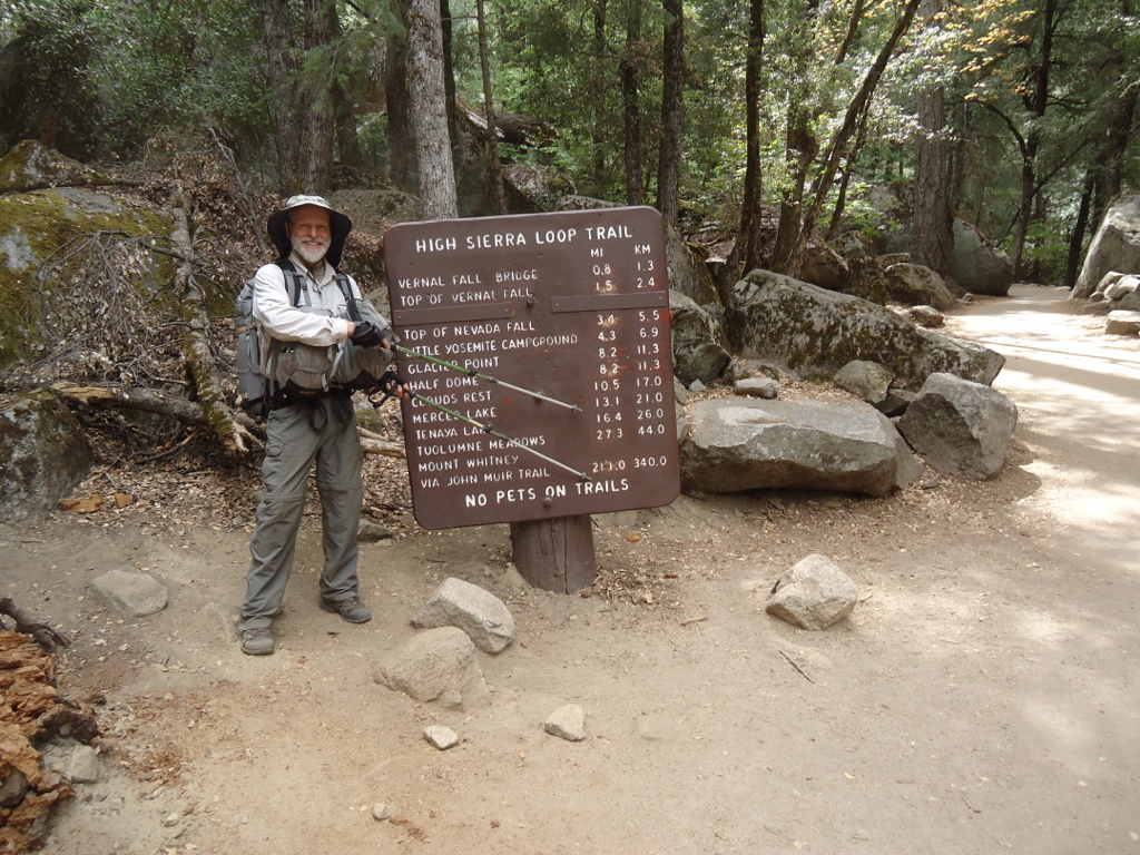
The next day I waited patiently for Jonathan and Kate to arrive in our aging twenty year old Dodge Grand Caravan. Nothing by noon. Nothing by 2PM. At about 3PM they both rolled into the parking lot, Jonathan waving a box in his hand. I was saved. With my backpack ready to go, I jammed my orthotics in my boots, took a few pictures with the kids, and ran off down the trail. As I walked, the anxiety of the previous few days slowly sloughed off like the skin of a snake. I actually had done it. I was on the trail, albeit much later than planned, but on the trail nonetheless. The elation of taking that first step on a long dreamt of adventure was truly thrilling. What marvelous sights would the John Muir Trail show me? Would I be different afterwards? Who would I meet? Only one way to find out. Walk on Dave.
Chapter 2-Death Wish
When I told my friends and family I was walking 230 miles by myself in the mountains, only a few understood. Most were puzzled, while some were genuinely concerned for my safety. A few even speculated on my sanity and apparent death wish. Only those with any outdoor experience could truly relate to my quest.
I would often reply to these well-meaning friends by saying, “You have a better chance of dying on the 405 than in the Sierra.”
“What about the bears and snakes and crazy people?” they would ask.
“Bears are not a problem if you are careful. And no snakes in the high country, at least no rattlers. And what serial killer is going to hike 50 miles into the backcountry?” I would respond.
I suppose this is all my father’s fault. I was his excuse to get out of the house when I was a small boy. By age seven I was fishing and hiking in the local San Gabriel and San Bernardino Mountains. Almost every summer we would vacation somewhere in the Sierra. My father’s favorite spot was Mammoth Lakes. The family photo albums are full of hiking and camping photos of Dave and his dad on some adventure. My long suffering mother would dutifully accompany us on our car camping trips, although she would have preferred a warm bed and hot shower. I hate to admit this, but I’m as bad as my father. Devoted outdoorsmen, we couldn’t get enough. And it was something we could do together with no arguments about politics or Vietnam or why I was living with my girlfriend. I still remember when my parents held a fund raiser at the house for Richard Nixon. I was livid. I wanted to disown them. How could they be that politically naive? But all that was never a problem when we were in the mountains. At least we could get along on some level. But that’s what the wilderness does, it removes all the needless and pointless layers of life and reveals its true essence. After he died at 55, I lost all interest in fishing. It was something that we did together and it never seemed right to attempt it by myself. By the time I finished college, I had backpacked throughout the Sierra. But I had never completed the JMT in one continuous trip, let alone by myself.
Then in 2012 I retired from thirty years as a college music professor. Now I had my chance. I kept waiting for my friends to retire in order to join me on this adventure but many were now incapable or couldn’t afford to retire. Some of my backpacking college buddies had even died. It was clear that if I waited much longer, I too would be incapable of such a walk. Only one thing to do now: go it alone. I’d done numerous week-long solo backpacks, but five weeks is a marathon. Cindy was supportive and urged me to follow the dream but I knew it would be hard on her. I timed my trip to coincide with the beginning of her school year so she would be insanely busy with the first few weeks of work. So I decided to do it. I started planning a full year in advance. There was a lot to consider. I didn’t want to have to hitchhike into a nearby town to get supplies. Thankfully, a backpacking buddy graciously volunteered to resupply me. I could mail myself food at other resupply points along the way as well. I planned to spend a few layover days at various backcountry resorts to recuperate. All I can say is that things rarely go according to plan. And no, it is not a death wish. I like to think of it as a life wish.
Chapter 3-Rain
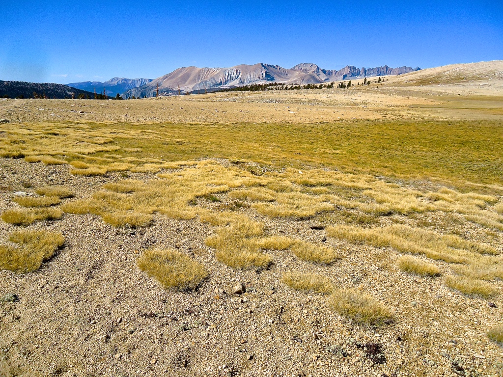
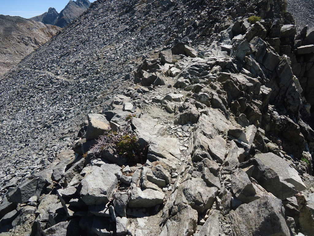
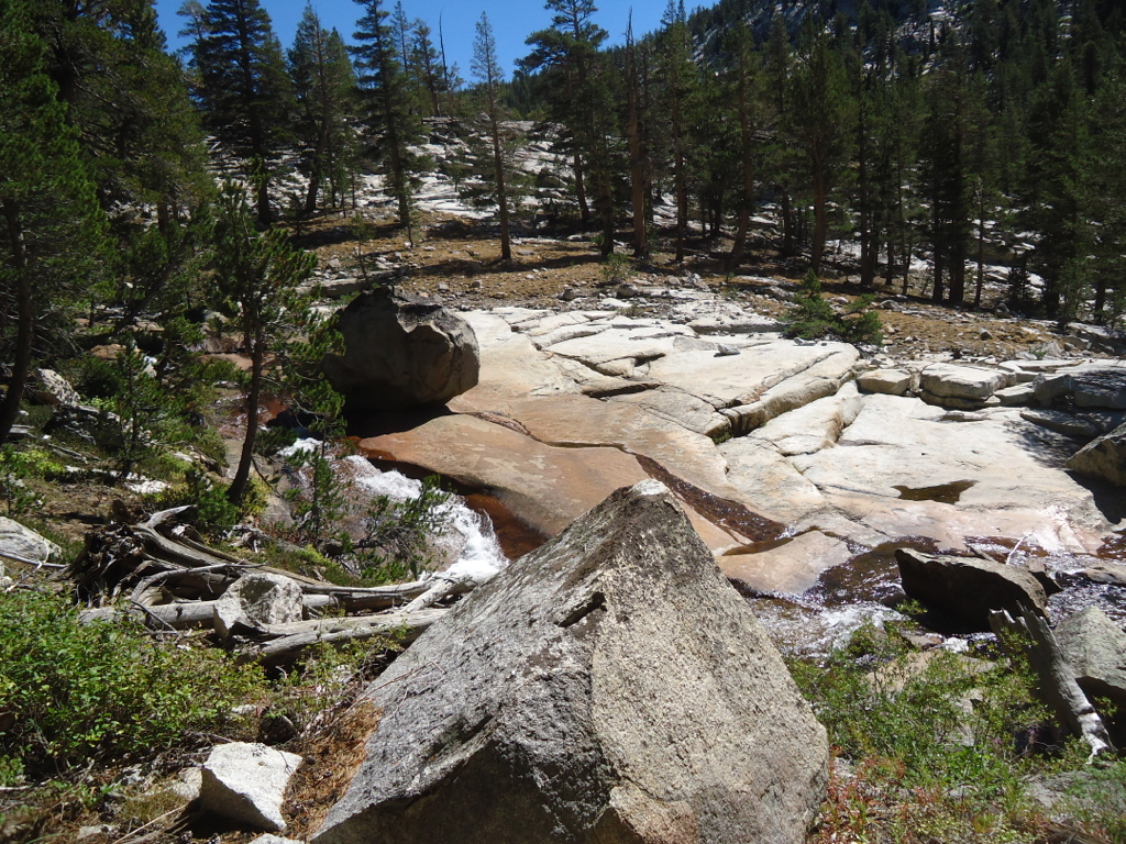
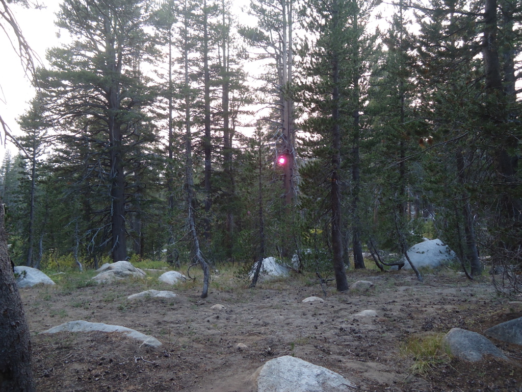
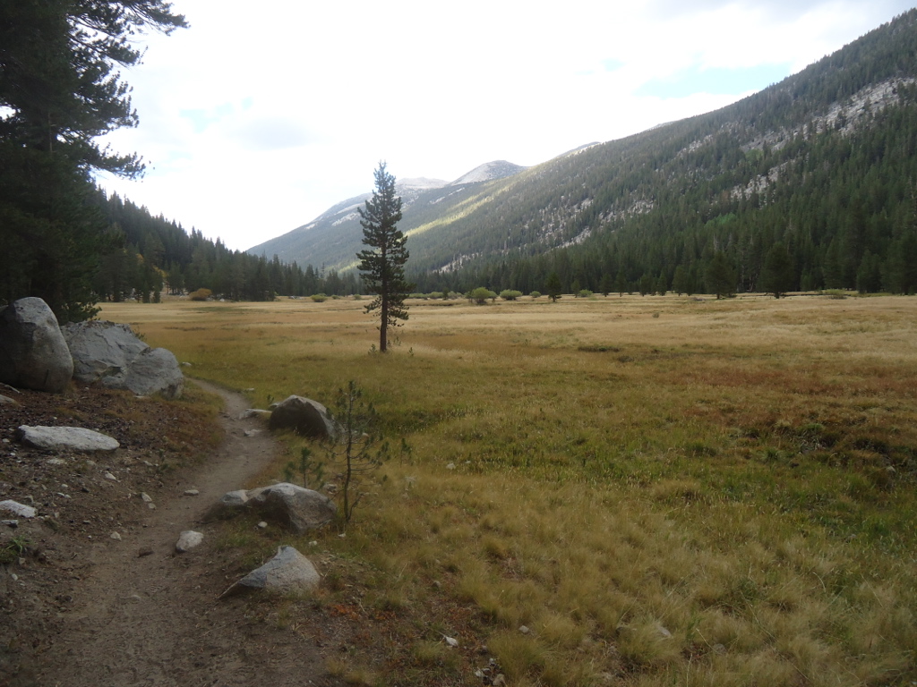
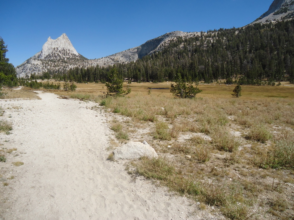
It takes a few days to become completely absorbed into the wilderness. More than a few days really. It took time for that mindless static and chatter to shut off in my head. In all my other backpacks I would hit that point around day three. As the routine of setting up camp and making dinner became habitual, a keen sense of focus permeated everything. Life was reduced to its bare essentials. It was so liberating. I was aware of so many other things. Like the direction and speed of the wind. And the phases of the moon. And the times of sunrise and sunset. I was also aware that my feet were taking a beating. I had over 100 miles on my boots without a problem and now they were giving me trouble? How is that even fair? So much for planning ahead. After a night at Chicken Spring Lake with about thirty other campers, I left the riffraff behind and headed for Rock Creek, my little toes becoming increasingly painful. Even mole skin wouldn’t help. It seemed the toe box was now somehow too small. It wasn’t before, which only added to my consternation. I hobbled along for a few more days before I finally, in a fit of frustration, took a knife to my boot and cut out a small portion to relieve the pressure on my toes. Two of my toenails were now black but the relief was instantaneous. Of course with two gaping holes in the upper part of my boots stream crossings would be problematic, but I really didn’t care. Good thing it was a drought year.
Starting at Horseshoe Meadow like I did, I was really doing the JMT backwards. And I didn’t even start at the proper place. My friends who had some knowledge of the trail didn’t understand why. But now that I’ve completed my trek, I am convinced that it is far better my way. The majority of JMT hikers start in Yosemite and finish at Mt. Whitney, just west of Long Pine. But there are definite advantages to starting at Mt. Whitney. First, the total amount of vertical feet is slightly less, 42,000 as opposed to 46,000. Secondly, finishing in Yosemite Valley gives you magnificent lodging choices in one of the scenic wonders of the world, as opposed to the arid desert landscape of Lone Pine. I have to admit that the Yosemite Lodge and the Ahwahnee Hotel were like dangling carrots at the end of the hike. I could wear a coat and tie to dinner at the Ahwahnee. Sit on the veranda and suck down a couple of large glasses of port. Listen to music in the piano bar. The third advantage was something I never anticipated, yet it was the most exciting of all. Walking northbound I came across hundreds of marvelous southbound hikers from all over the world, some of which I keep in contact with to this very day. This would not have been the case if I had started in Yosemite. There were hikers from France, Germany, New Zealand, Australia, Canada, and all over the U.S. On one occasion I came across a father and son from Ohio. They jokingly said they had completed the John Deere Trail and were now doing the John Muir Trail. I visited with a southbound family of four with two girls, ages ten and thirteen. They were almost to Mt. Whitney and anxious to complete their two-hundred mile trek. Near the Woods Creek bridge I met a family of three. Their son was only seven and they were walking the entire JMT! Then there were Pacific Crest Trail hikers with lithe bodies that passed me like I was standing still, walking over thirty miles per day. Something special happens when you hike the JMT. It’s like you’re part of some big, spread out family. Almost everyone would stop and talk enthusiastically about the latest weather report or the trail conditions. There was a phenomenal esprit de corps. I saw almost no one walking northbound like myself. But there are disadvantages to starting from Mt. Whitney too. And that’s the difficulty of getting a permit, having to pack out your poop in a nasty little bag, and sharing the trail with literally hundreds of other hikers. This was not what I had in mind. In order to circumvent these troubles, I started one drainage south of Whitney at Horseshoe Meadow. It was easy to get a permit, there were hardly any people, no poop bags required, the landscape was far more beautiful, and the trailhead was almost 1,500 feet higher. And it added only twenty extra miles to the trip. Sign me up.
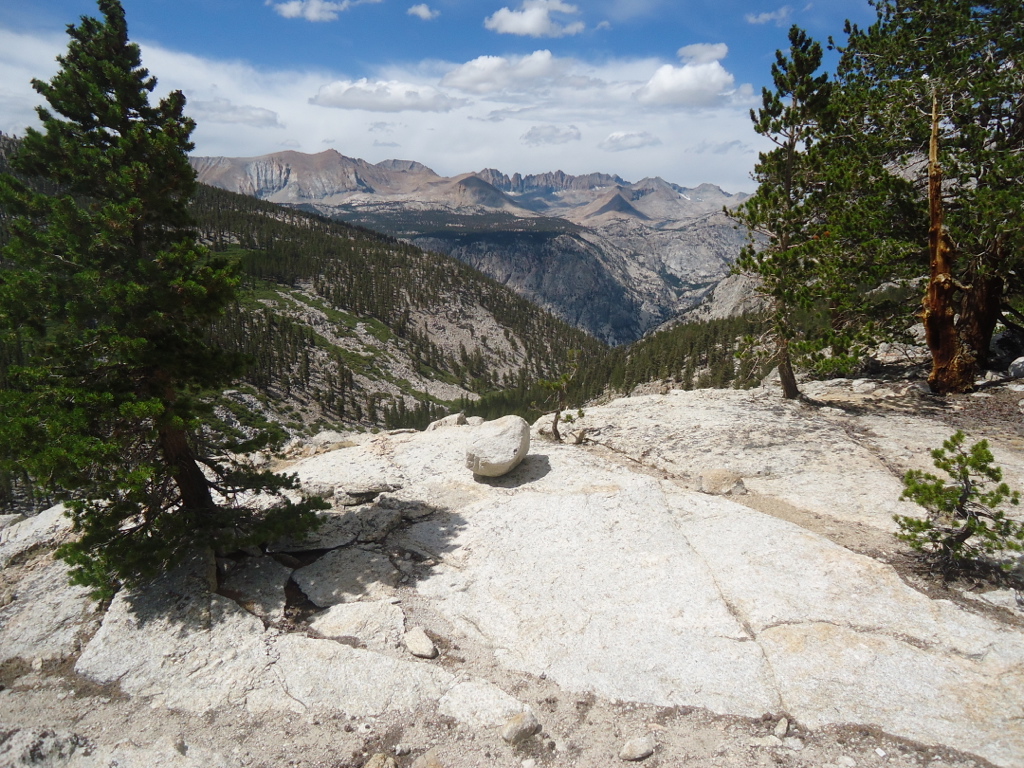
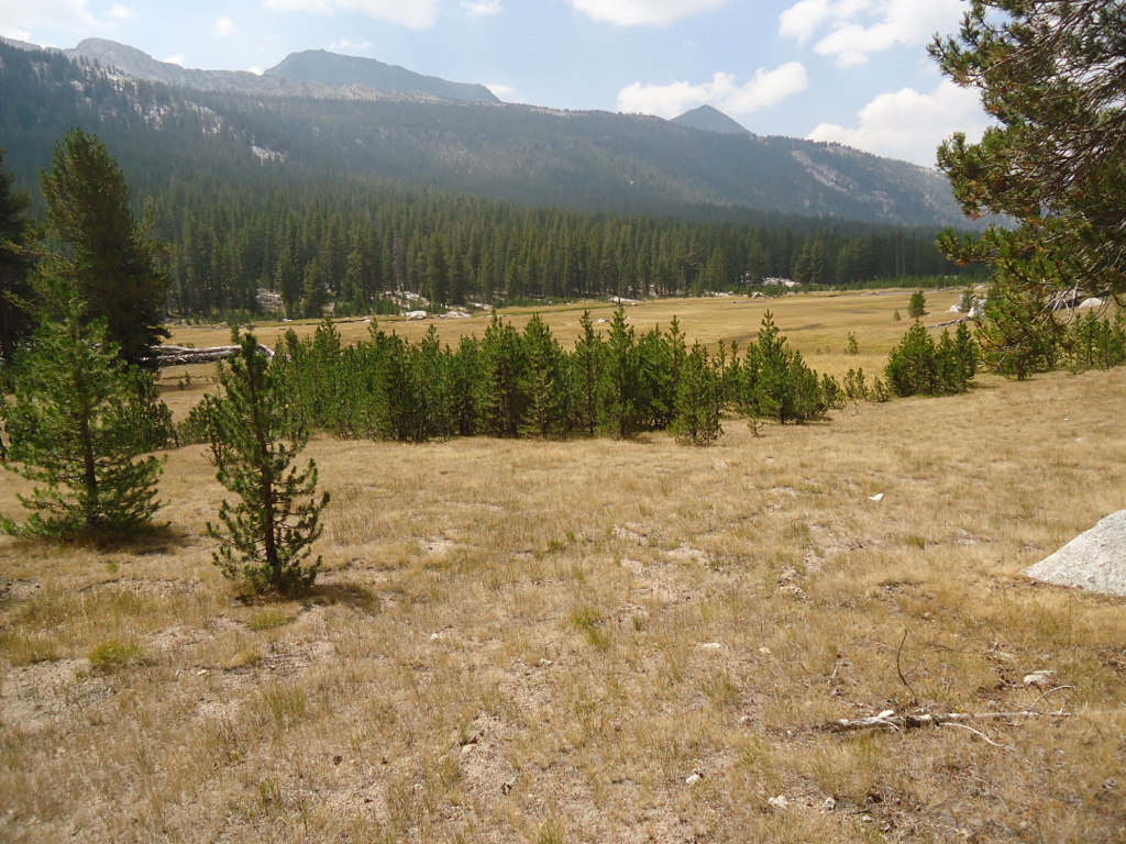
After Rock Creek, the next few days took me through spectacular country: Crabtree Meadow, the Kaweahs, the back side of Mt. Whitney, Bighorn Plateau, and views of the immense trench of the Kern River.
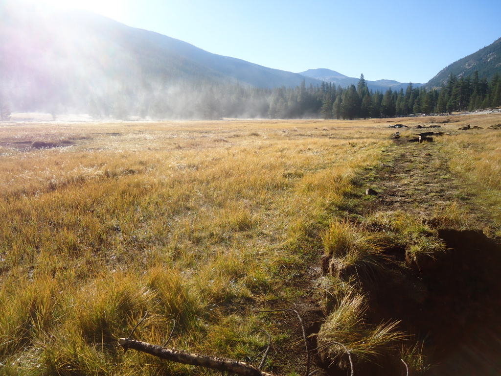
About day five things began to change. The wind now came from the south carrying heavy looking cumulus clouds. I could feel the increasing moisture in the air. For almost five straight days it rained off and on, but mostly at night. The snow level dropped to about 12,000 feet, leaving the higher peaks covered in a dusting of white. The trail crew on Forester Pass warned me that another serious rain storm was on the way and I should get over the pass by no later than 2PM.
This same scenario played out for the next few days: light sprinkles during the day and heavy evening thunderstorms. At Charlotte Lake I pitched my tent in a driving hale storm.
At Sandy Meadow I came across a young JMT hiker carrying a backpack that couldn’t have been more than fifteen pounds. It was more like a knapsack, yet he was doing the entire JMT. Then he told me his secret. He didn’t carry much food. What? How is that even possible? There are bear boxes periodically along the JMT for campers to safeguard their food. Evidently people leave extra food inside that they no longer wish to carry. He was a scavenger! If he couldn’t find sufficient food in the bear boxes, he would hike out to the nearest town for his supplies. He assured me that he rarely had to do that. Amazing!
Chapter 4-Solo
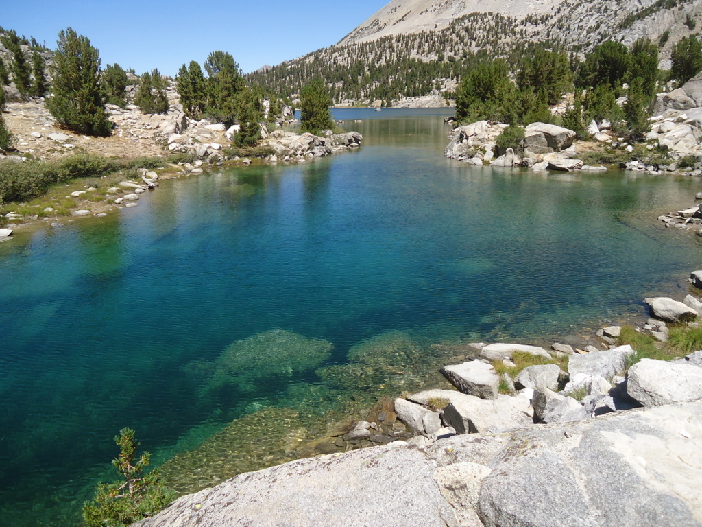
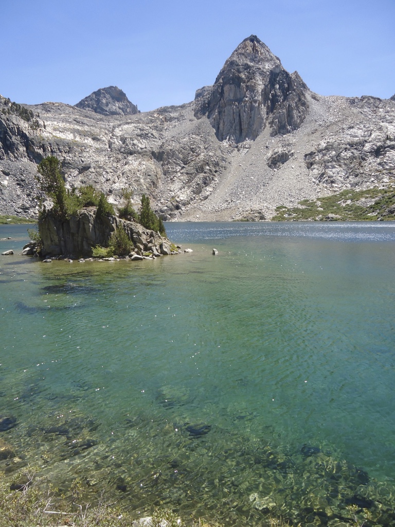
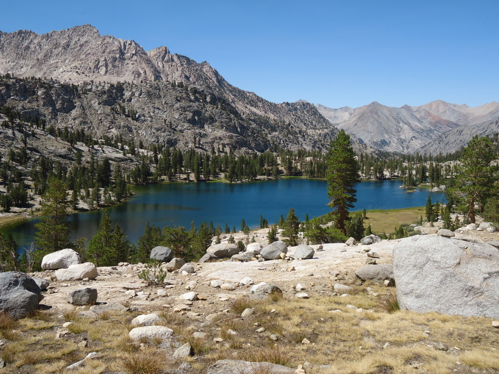
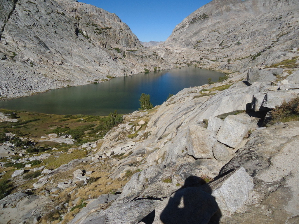
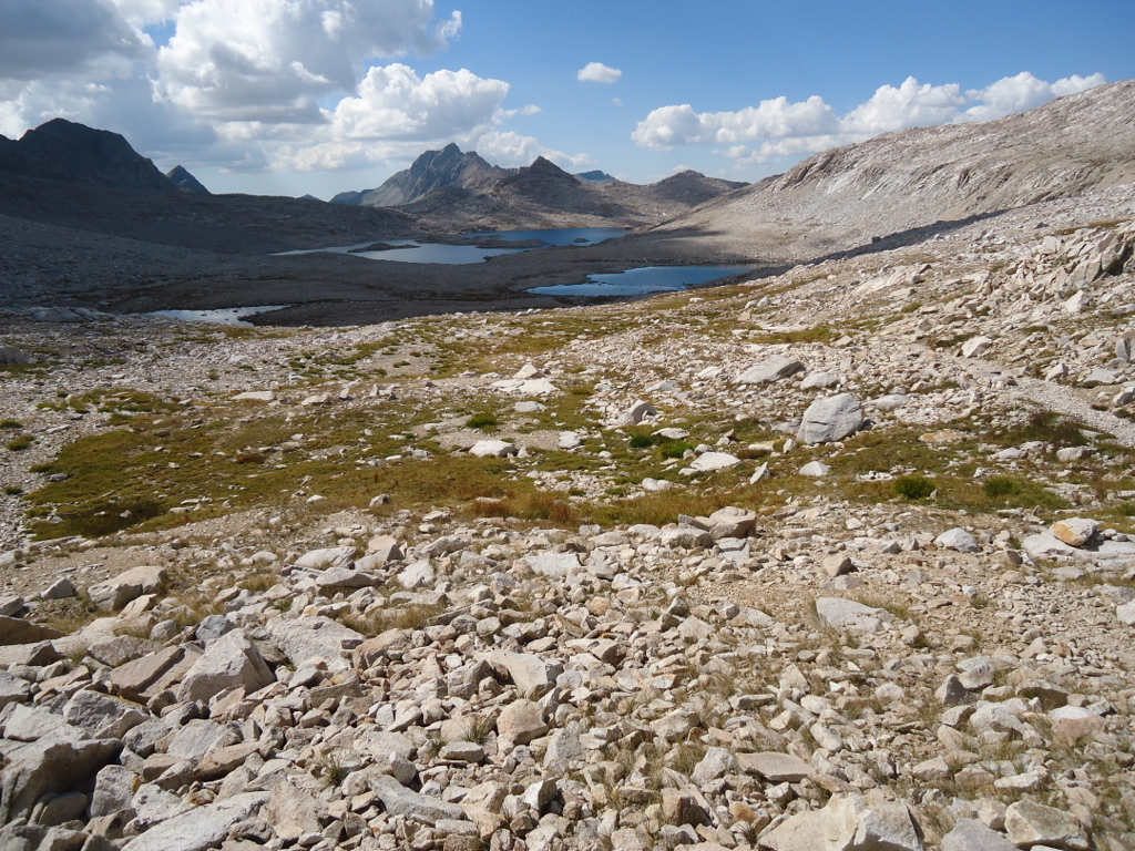
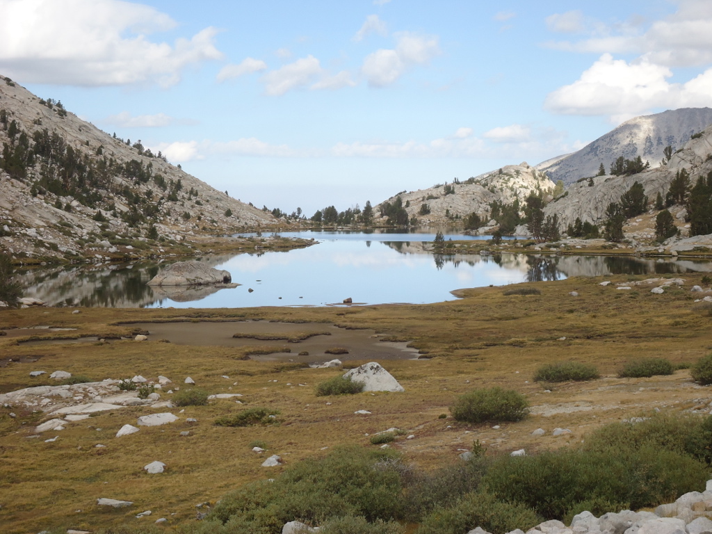
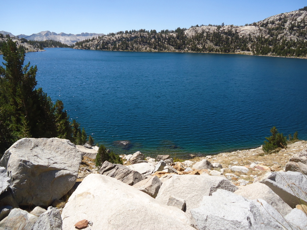
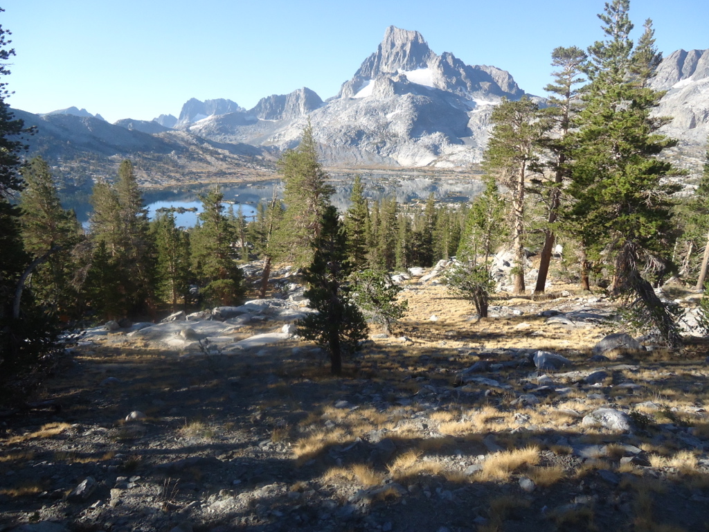
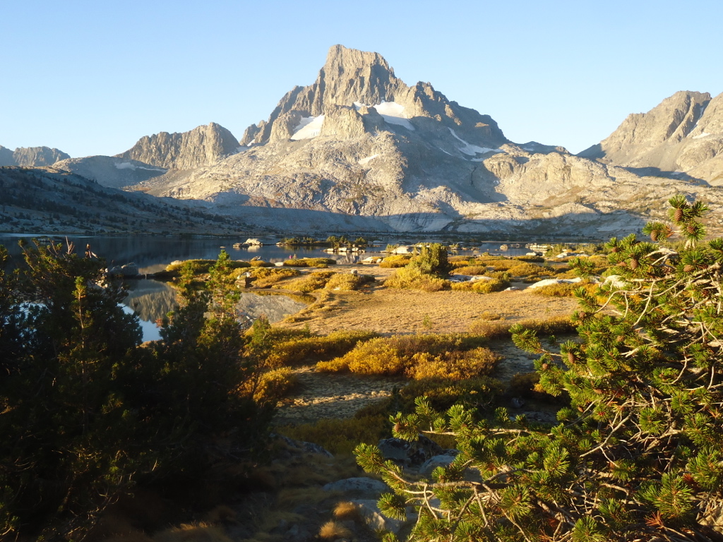
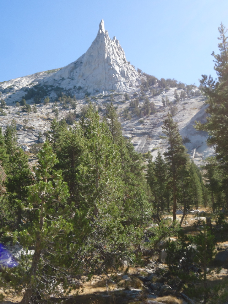
The Rae Lakes Basin is one of the most beautiful collection of lakes in the Sierra. The jagged granitic outcropping called the Painted Lady looms like a lonely sentinel at the head of the canyon.
“What did you think about all day,” someone asked me when I returned.
It is a very unique thing. Being alone for weeks at a time. The isolation acts as a kind of filter, eliminating all superfluous thought. The bullshit just falls away. Aside from the obvious need to deal with eating, navigating, and staying warm, only those things that are truly important seem to come to mind. Family, life experiences, friends, and of course music. It was like some kind of slow movie of my life at times. I would review an experience in great detail. Like the death of my mother and father. The birth of my children. And the death of my first wife Nikki, who died tragically at 47. I would attempt to assess how these events changed me and the course of my life. And how I chose to react to these events. Of course, I could never make sense of it all. Especially disconcerting was my less than stellar behavior as a youth. Looking back as a sixty-four year old, my behavior seemed so juvenile. But I suppose we all have our youthful indiscretions. Most painful was how my behavior hurt those I loved. I vowed to never behave that way again. But at sixty-four, that revelation is a little late in coming. Still, self-evaluation is always a good thing. I came away with the epiphany that so much of our lives are filled with meaningless nonsense and that people are our true treasures. And of course, how lucky I was to be able to finally pursue my hiking dream. At this point in the walk, I was content to be solo and only slightly lonely. I wished my family could see what I was seeing. But things gradually changed in the following weeks.
There was always music running through my head. The opening of Mahler’s Sixth Symphony kept me marching down the trail. I composed in my mind as I went along. I would imagine music in a variety of styles from Baroque to Stravinsky. To keep my ears sharp, I would mentally transcribe music into notation. I really wished I had a guitar. I would sing a lot. Especially Jackson Browne. No one seems to capture the essence of the human condition quite like Jackson. Jamaica Say You Will was a tune I would sing almost everyday. I would review the tunes from my two musicals, Haight and L.A. Vida. It took me three days to remember the lyrics I wrote to one of these songs! I was so mad. I couldn’t even remember what I had personally written! I worked out some basic themes for a new project called The Dream of Sitting Bull. For full orchestra, it is a tone poem based on the famous dream Sitting Bull had just before the Battle of Little Big Horn. I would reflect on the influence nature had on the famous composers. Mahler’s nature-fueled inspiration. Grieg’s famous fishing stories. I never gave a thought to the mortgage, gas bill, or the house remodel. This is the real life, free of all those mind numbing encumbrances. This is how to be truly free.
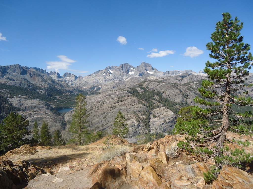
Of course, the music and self-reflection were a distant second and third to the monumental beauty of the Sierra. Despite my almost fifty years of backpacking in the Sierra, at every outing I would be awe struck by the overwhelming beauty and immense scale of these mountains. Each trip was like my first. It was a truly humbling experience.
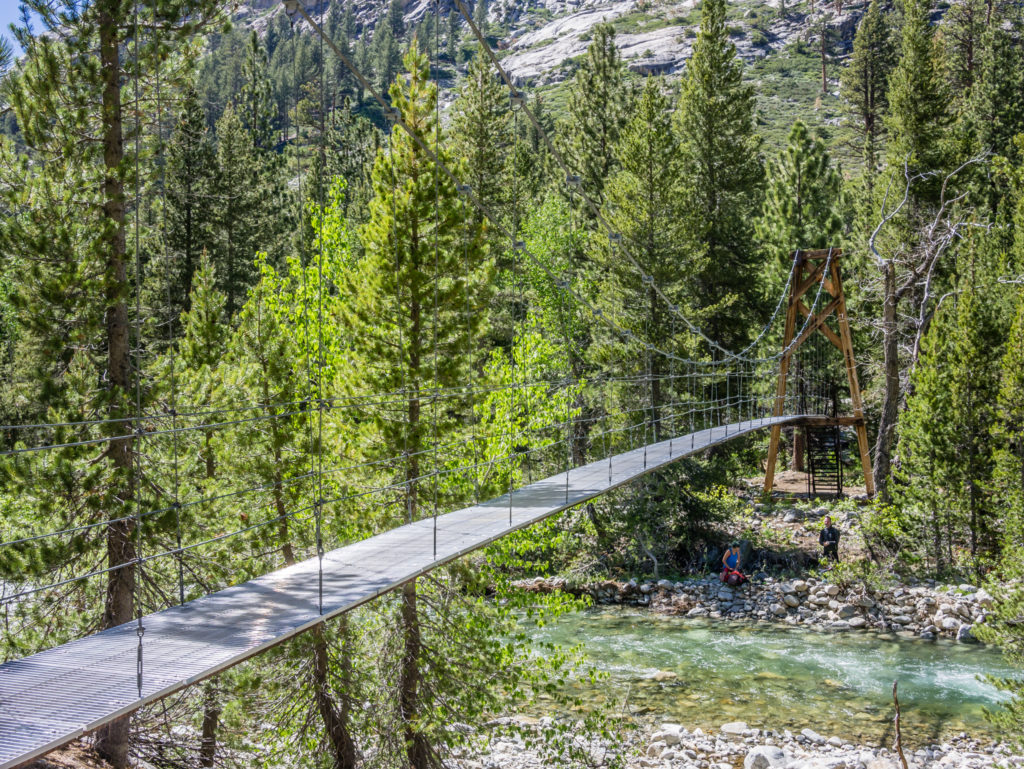
After Rae Lakes I gradually descended down Woods Creek where a very wobbly suspension bridge spanned the creek.
“You don’t filter?” I asked.
“Never have,” he replied.
“I never used to, but my wife made me promise,” I said.
He laughed and replied, “I’ve been hiking in the Sierra for over thirty years. Never been sick. Ask any of the rangers around here. They don’t filter. The Forest Service and Park Service recommend it just to avoid any legal trouble.”
“I figure if you use a little common sense you can avoid it. And most people confuse cryptosporidium with giardia anyway. It’s usually bad camp hygiene and not the water.”
He nodded in agreement and started off down the trail at a good clip. I wanted to grill him about his ultralight backpack. Where was his sleeping bag? He couldn’t be carrying much food. Did he carry rain gear? He obviously had it down. I wish I knew how.
At this point I had run into a sizable amount of JMT walkers heading south. And many of them were solo women. In the past this was a rare thing, but with the advent of Cheryl Strayed’s book Wild, there seemed to be an abundance of hiking women. Unlike Strayed, these women were generally well versed in backpacking and knew what they were doing. They were universally friendly and always wanted to talk, even to an older solo gentleman like me. Ah, youth.
After crossing the Woods Creek wobbly bridge I started the long grind up towards Pinchot Pass, named after Gifford Pinchot, the famous forester and politician.
It was certainly a fisherman’s paradise. My father excelled at stream fishing, a skill I learned at an early age. We would dress in dark colors and approach the stream banks like stealth bombers. When I was learning, I would invariably foul my line in the trees while attempting to cast. Or snap the tip of my rod off on a tree trunk. Yet he never angered and would then demonstrate the proper stream technique. Without him I really didn’t have any inclination to fish at all.
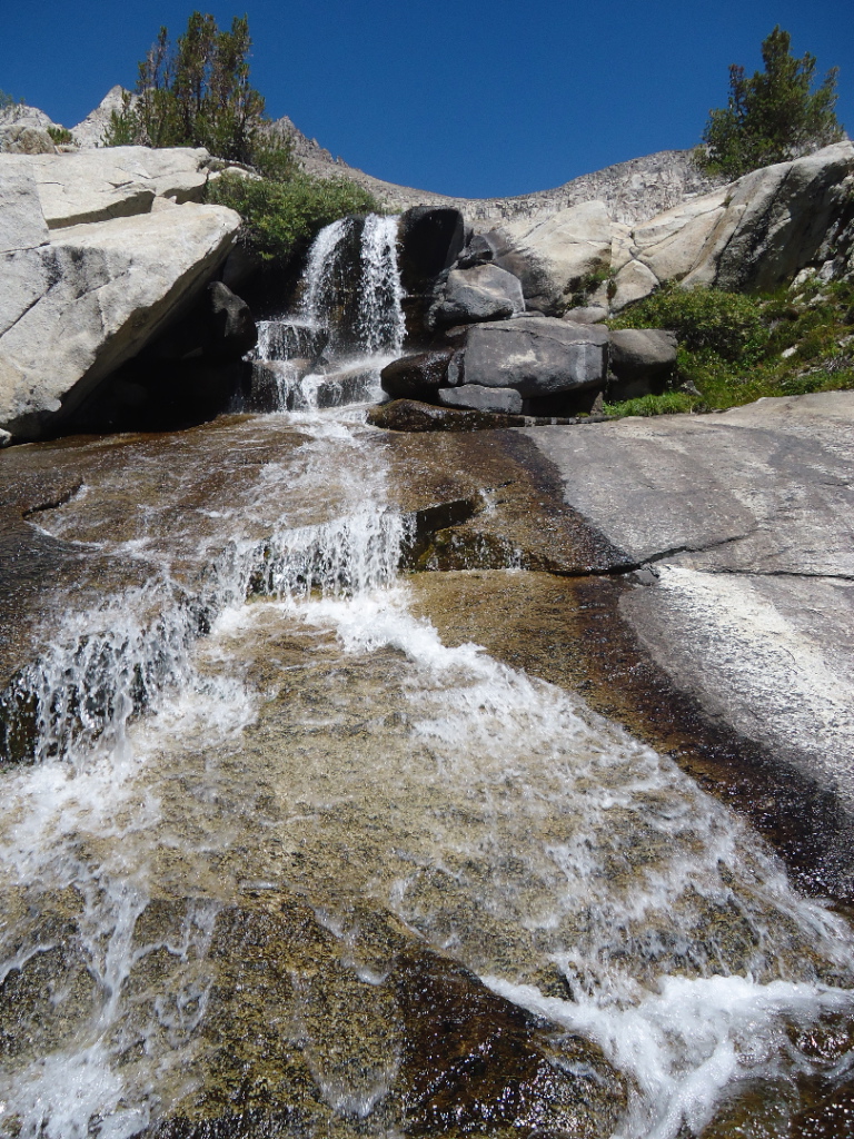
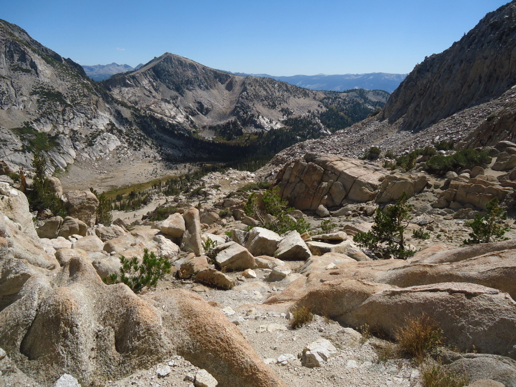
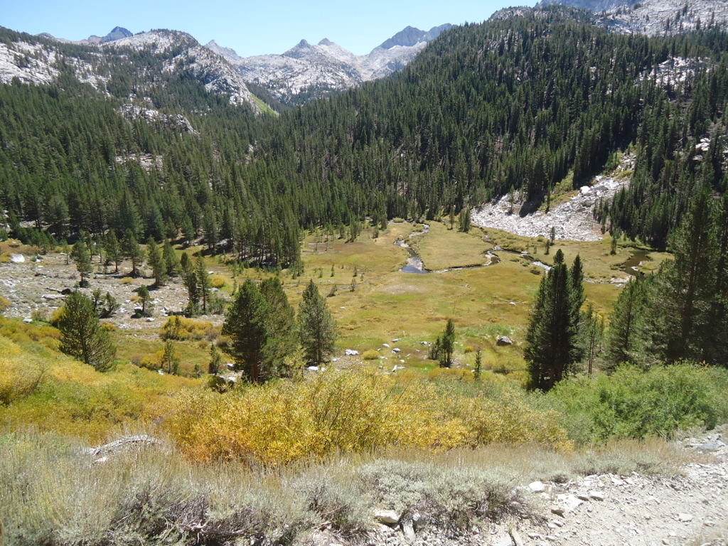
The south side of Pinchot Pass is certainly the most colorful pass on the entire JMT. The ridge just west of the pass is capped with a huge, deep red monolithic chunk of metamorphic rock called a roof pendant. At its feet perched ten small tarns, gray granite rock fields, and mustard colored sedges and flowers. All this with a backdrop of a cerulean blue sky. At the top of the pass a couple on their honeymoon took my picture and I was happy to take theirs. The stretch from Pinchot Pass down to the South Fork of the Kings is relatively dull by JMT standards. I started early and made the South Fork before lunch. Now came the long haul into the upper basin of the South Fork of the Kings River. As I worked my way up the canyon the upper basin gradually revealed itself. Relatively flat and miles across and even longer in length, it almost defies description. I made camp that afternoon next to the stream, the evening light rolling around the huge basin until after 9PM.
A curious thing happened over the course of the next few days. And elderly couple happened to be heading northbound like me. They were out for about seven days and would exit at Piute Pass, a few days north. Elderly? Who am I kidding? They were my age. I suppose they seemed elderly since they appeared to be so clueless. We walked about the same speed and would pass each other a few times each day. This went on for almost three days. At one point I caught up with them as the gentleman was poring over his map. He asked me a few questions and I realized he was holding the map upside down. No wonder he was confused! I straightened him out and after the next day I never saw them again. I hope they made it. The next day I easily ascended the smooth, nicely graded trail to Mather Pass.
“Alright, make a circle,” a voice called.
“Good. Now loosen up that neck,” it continued.
In my foggy state I could not understand what was going on. I stepped out of my tent in my long underwear and surveyed the scene.
“What the hell,” I said under my breath.
About thirty feet from my tent stood approximately thirty-five young people in a circle on a large, flat area of granite. They appeared to be stretching!
“Is this some backcountry yoga thing?” I said to myself.
The voice continued, “Now leg stretches.”
I watched in utter bewilderment with no concern that they all could see me staring in disbelief. And in my long underwear too! But hey, it’s the wilderness, right?
They stretched for a few minutes more and then the leader announced the day’s assignments.
“Holy shit, it’s a trail crew,” I mumbled.
I had camped right next to a huge trail crew camp. And their outdoor latrine wasn’t far away. I must have been upwind when I rolled into camp, but I sure as hell was downwind now. After their meeting, they all grabbed their tools and went off to their assignments. As I headed down Palisade Creek I came across many of these young people.
“Oh, you’re the long underwear dude,” they would say.
“Yeah, that’s me,” I replied.
“Hope we didn’t wake you up.”
We all laughed and I continued on my way down canyon towards Deer Meadow, passing through the infamous Golden Staircase carved out of solid granite.
“There’s a grass fire off of highway 180 near Sanger,” a group of three middle-aged men informed me.
One of them made an offhand comment about my odd looking backpack. I didn’t bother to respond. His loss, I figured.
“If you get farther up Le Conte Canyon you’ll get out of most of this stuff,” they advised me.
Grateful for the information, I thanked them and headed up Le Conte Canyon as quickly as I could. Bad idea. The harder I pushed, the more my lungs began to burn. I relaxed the pace a bit and hoped to make it to the Le Conte Ranger Station. About a mile shy of the ranger station I spotted a faint use trail heading down towards the creek. It was a stock camp. I was starting to get pretty good at finding these camps. The packers always knew the best places to camp and often times were off the beaten path. Unless, of course, it was littered with horse caca. But most of them so far had been fine. It was a fabulous campsite. Large sandy beach on the stream and plenty of grass. About midnight that night, I was jolted out of a deep sleep by what sounded like an army marching. I had never heard that kind of thing before in the Sierra. I whipped out my headlamp and stuck my nose out the tent door. Not more than four feet away was an army alright. An army of deer. Over ten deer were cruising through my campsite. They obviously liked the grass too. Relieved, I went back to sleep thinking of what the next day would hold: my buddy Jerry with a resupply cache and a couple of layover days at the Le Conte Ranger Station.
Chapter 5-Aarn and Spot
I promised Cindy I’d buy some kind of tracking device or satellite phone for my trek. But for five weeks the rental price of a sat phone was unreasonable and the DeLorme InReach was over $400. So I settled on the Spot Gen 3. While the DeLorme gave you text capability and navigation, the Spot would beam my position to a satellite and then plot it on a topo map. It was accurate to about three meters. The topo map was available to anyone via the web and my worried wife could track my progress day to day. Or so I thought. So I would send my position via satellite about ten times each day hoping this would placate my poor wife. Spot also could send a few simple messages too. Like “I am okay” or “I am in trouble, send help.” I never needed these but it was reassuring nonetheless. When I returned I learned that many of my friends were following me closely all the way to Yosemite!
There was one problem that freaked Cindy out and worried some of my followers. For some unknown reason, my position for almost five days failed to materialize on the webpage, despite my sending multiple messages each day. I had disappeared. For a stretch of almost five days before I was to meet Jerry for my resupply, I was nowhere to be seen. Cindy frantically called Jerry for his opinion on the situation. Jerry reassured Cindy that it was probably some kind of technical problem. And he turned out to be right. After five days of blackout, I magically reappeared on the topo just before I was to meet Jerry. From Le Conte to Yosemite the Spot worked fine. Cindy was most grateful. While the Spot was a useful tool, I missed even some kind of communication with the outside world. Even text messaging would do. Next time I guess.
About eight years ago I came across a marvelous backpack from New Zealand. Based on the principle that the load should be equally balanced forward and aft, it was equipped with large pouches on the front side of the pack. This was obviously a radical new approach, but it made perfect sense. With a balanced load, the hiker walks upright, experiences no back fatigue, and has quick and easy access to items in the front pouches. Aarn packs are hardly known in the U.S. and mine always caused great interest. Out of hundreds of people I visited with on the trail, only two people had ever heard of this pack. Nonetheless, people wanted to know all about it and after the first few times I memorized the same explanatory speech. One young hiker was particularly interested and asked me if he could try it on himself. He strapped it on and went skipping down the trail extolling the Aarnpack’s virtues! Another convert. Yet I am at a loss to explain why it hasn’t caught on in the U.S. In fifty years of backpacking I’ve tried almost every style of pack. The Aarnpack is without a doubt the most comfortable pack I have ever used. Even after witnessing the Aarnpack in action, my backpacking buddies have yet to be convinced.
“Let’s take a break,” my buddies would say at the top of a pass or at the point of back exhaustion.
They would bend over forwards, put their hands on their knees, and try to take the load off their backs. I couldn’t help but make a wry comment as I stood upright, pain free, and surveyed my needlessly suffering friends.
“Dudes, I keep telling you, you’ve got the wrong backpacks.”
I think there is some mind set for backpacking Americans. We don’t handle change well. For the first fourteen days I carried all my own food without a cache. The Aarnpack handled my 32 pounds with no problem. After Jerry resupplied me at Le Conte Ranger Station, I would carry no more than 22 pounds for the rest of the trip. I learned a marvelous trick from a PCT hiker a few years ago when dealing with food. Instead of using the dehydrated food pouches to cook each meal, I would remove all the food from the pouches before hitting the trail and put them in burnable paper bags. All I needed was a single pouch that I could reuse over and over. The only hitch was the no fire regulation that had gone into effect on July first. So I would discreetly burn my paper bags early in the morning just before I was leaving my campsite and quickly leave the scene of the crime. On a previous ten day backpack, all of my buddies didn’t put much stock in my paper bag trick and had opted to carry all their dehydrated food in their original pouches. By day ten they were all complaining about how smelly and bulky the used pouches were. Not to mention the fact that all those food encrusted pouches were an obvious invitation to any bears in the area.
Looking back now I can see I was slightly calorie deficient each day. By the end of the five weeks I had lost about fifteen pounds. And I wasn’t even overweight! On my previous backpacks I had never been in the backcountry for more than ten days. Hardly enough time to really lose any significant mass. But over the course of five weeks, even a minor calorie deficiency would start to add up. My usual oatmeal, trail mix, soup, and dinner rations were not quite enough. Especially if you walk between six and eight hours each day.
Chapter 6-El Presidente
The plan was to meet Jerry on day 14 at the Le Conte Ranger Station.
“Dave told me it was day 14, but was it really day 13?” Jerry asked his wife Cheryl.
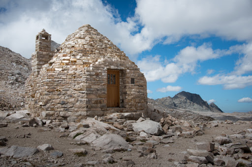
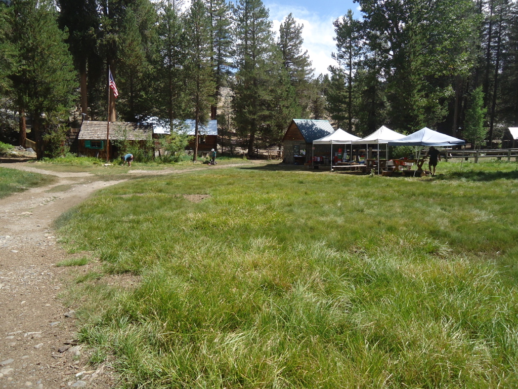
He called Cindy and they all agreed I was just a little early. I rolled into Le Conte Ranger Station early on day 13. There were a number of delightful campsite spread out over a large area. Only a few campers were there. I found a secluded spot above the ranger station and close to the creek. By arriving a day early I had earned an extra layover day and I planned to do some serious relaxing. I set up camp and decided to explore the area. The ranger station was a log cabin structure identical to the one at Rae Lakes. The ranger was out on patrol and in the three days I was there I never saw him. In fact, despite all the ranger stations I did come across, I never saw a ranger the entire trip. The station had a few chairs scattered around and a bulletin board for hikers to leave messages. I sat down and read for a few hours. The meadows around the station attracted a large group of deer that seemed to permanently hang around all day. Almost totally fearless of humans, I could get within about ten feet of the does. I counted more than five fawns with their beautiful spots and even a few bucks. A young German named Kristoff arrived at the ranger station in the afternoon. He had flown into San Francisco, purchased all his hiking gear at REI, and set out to do the JMT. His English was impeccable. We talked about Bach and Wagner and all things German. Later in the day a young man from Holland arrived. Remco had been working in the U.S. for about seven years in the digital audio industry. Needless to say, we had a lot in common and talked for quite a long time. Later in the afternoon, two women from Steamboat Springs arrived, Ursula and Carrie. Ursula worked in the wine industry and Carrie was on the Steamboat Springs city council. They pitched their tents nearby and all five of us had the most delightful dinner together. What a novel idea! After two weeks of eating alone, I was thrilled to have a meal with another person!
The next day I passed the time until Jerry and Spence would arrive by visiting with a few new hiker friends. Connie Ayers was a doctor from Sebastapol and about my age. We talked about our children as all good parents do. She was doing only part of the JMT and hiking alone. I was amazed at the size of her pack, which didn’t seem to slow her down. Tough lady. After an hour or so of schmoozing she headed back to her campsite and I waited for Jerry and Spence while having some lunch in the oversize ranger station chairs. After an hour or so, Jerry came walking through the trees. My food! And a good friend. But no Spence. Evidently Spence had to bow out due to food poisoning in Las Vegas. I guess what happened in Vegas did not stay in Vegas. Poor Jerry was loaded to the gills with his own gear and my resupply food. Still, he looked relatively unfazed after such an arduous hike. We greeted each other warmly, set up his camp, and headed for the creek for a swim. Then back to the chairs for some relaxation. Jerry told me of the Spot Gen 3 trouble and how I had disappeared for almost five days to Cindy’s concern. That night we had dinner with Connie and two new friends, John and Donmienne. John and Donmienne were from San Diego and were waiting for the pack station to come and rescue them. Poor Donmienne had injured her knee coming down the south side of Muir Pass. Even after a few rest days at Le Conte, she was unable to walk without serious pain. Her dream of hiking the entire JMT was shattered. She was almost in tears as she told Jerry and me of her disappointment. As we visited during dinner, I discovered that John’s last name was Clark. Donmienne was clearly a beautiful young Chinese woman and they had been married for a few years. In my musical Haight, the lead character is named John Clark and his girlfriend is Chinese. An almost unbelievable coincidence.
After dinner we returned to our campsite and savored a little El Presidente brandy that Jerry had brought along. After weeks of dehydrated dinners, ramen, and trail mix, this was truly nectar of the gods. Now I really wished for a fire and a guitar. It would have made the perfect backcountry trifecta: alcohol, music, and a fire. The next day we walked down canyon with John and Donmienne to admire the cascades that emanate from Ladder Lake.
“This is for you,” he said.
“What is it?” I asked.
He simply handed it to me. I unscrewed the lid and was immediately delighted by the wonderful aroma.
“El Presidente!” I exclaimed.
Over the next ten days I would savor those precious twelve ounces. It was a little bit of extravagance from the outside world. Thanks to Jerry. The next morning Jerry left for home over Bishop Pass and I headed up Le Conte Canyon towards Muir Pass. After all the wonderful schmoozing and trail camaraderie at Le Conte, I was now on my own again. With my pack at twenty-two pounds and my legs and lungs well-acclimated, I was walking with greater ease. But soon the southbound JMT hikers brought word of trouble in Yosemite. Fire!
Chapter 7-Fire
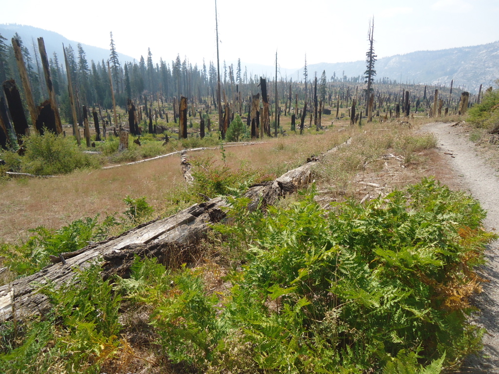
The Rim Fire started on August 17, 2013 and was the largest Sierra Nevada wildfire in California history, having burned about 400 square miles. Started by a hunter’s illegal fire, it burned from near Groveland all the way into the backcountry of Yosemite National Park. Southbound hikers informed me of this monumental blaze and even shared photos that resembled the mushroom cloud of an atomic blast. I was lucky that the prevailing westerly winds were blowing most of the smoke to the northeast, affecting air quality in Lake Tahoe and Reno. Nonetheless, I was to find out that wind patterns change and I would not be spared another smoked-filled portion of my walk. But for the next ten days the weather was pristine and cool, ideal for hiking.
So Jerry and I parted company at Le Conte Ranger Station on August 30th, Jerry heading back over Bishop Pass and me heading for Muir Pass. It was now my 16th day on the trail and was definitely hitting my stride. Coming into Le Conte my pack was approaching about 18 pounds, my feet had recovered, and my legs and lungs were accustomed to walking for hours each day. With a few days rest and my new resupply, I was back to about 23 pounds, a very manageable load. And I had some El Presidente! Jerry brought me some reading material too. I was too obsessed with saving weight and didn’t bring anything to read! Bad idea, but next time I’ll bring a good paperback, like an biography of Mahler or Stravinsky.
And then there was MTR, Muir Trail Ranch. And only a few days away. MTR is an oasis close to the JMT where hikers can pick up their resupply food, enjoy a hot meal, stay in a cabin, and soak in the natural hot springs. After more than two weeks on the trail, this was sounding very, very good. But I had to cross Muir Pass, traverse Evolution Basin, and walk along the South Fork of the San Joaquin.
It was a long day from Le Conte to my next campsite at Wanda Lake.
As she approached me I called out, “We finally made it!”
She promptly sat down and began to cry. The man perched on the rock came over and offered her some advice as if he were some kind of coach. I think she was training for some kind of Sierra marathon or the PCT. He didn’t seem very sympathetic, so I offered some words of encouragement as I headed down the north side of the pass.
“It’s all downhill from here. Easy walking!” I said.
No response, only tears.
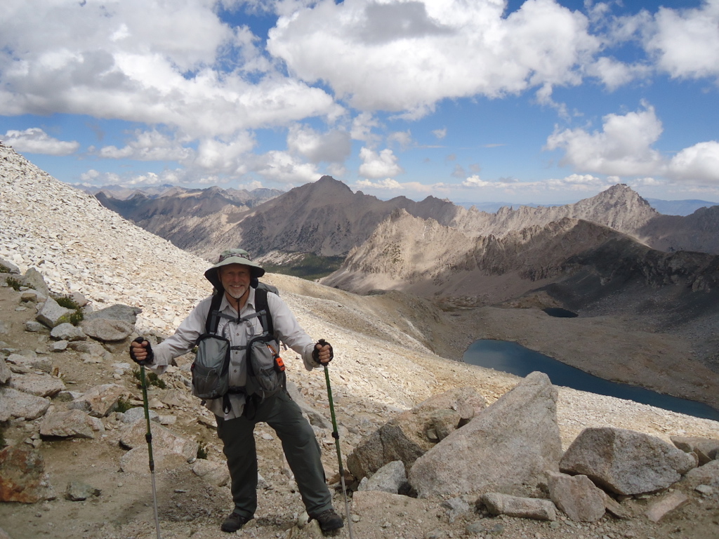
Farther down the trail I was passed by a young solo hiker going north at a good clip. I thought I would try a little experiment. I would try my best to match his pace. While I’m not a slow walker, I average around two to three MPH on the flat and one to two MPH going uphill. So I lengthened my stride and quickened my cadence. He was still pulling away. So now a quicker pace. He was still pulling away! I began to jog, the pack bouncing up and down on my hips. It must have been a comical sight. Only then was I able to even approach this super hiker’s speed. I gave up in frustration. I told myself that all those speedy PCT and JMT hikers could never see and appreciate all that my slower pace would afford. I think I will stick with that lame rationale. I could always chock it up to my advanced age. That is always a good one. I do have to say with some sense of pride that I was one of the oldest JMT walkers out there. I did come across an 80 year old woman near Pinchot Pass carrying a small day pack. We visited for a few moments as I asked her about her lack of a backpack. She pointed down the trail to her two sons, loaded to the max. They were struggling up the pass like beasts of burden, carrying everything their mother would need. One son even carried a guitar. But she was out there doing it at 80 years old! I was impressed. That’s what I want for my 80th birthday! A trip in the Sierra backcountry where everyone has to carry my stuff!
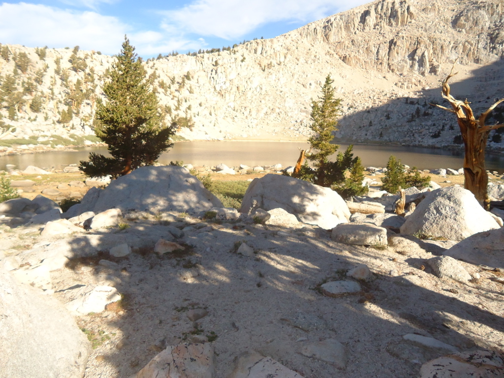
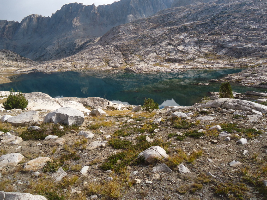
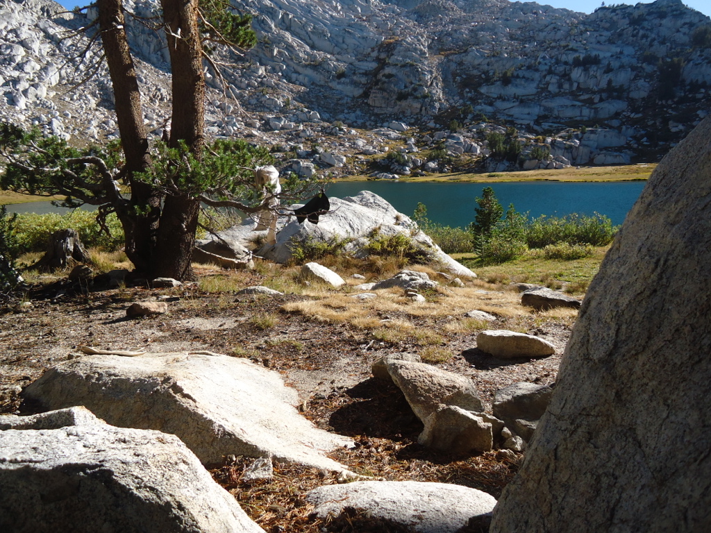
My Wanda Lake campsite was like the prow of a boat, sitting about 30 feet above the lake. One of the southbound walkers called it his “Fortress”. The entire Evolution Basin just north of Muir Pass sits well above 11,000 feet, with not a tree or any vegetation to be seen. It is a lunar landscape. Due to the drought, there was no snow on any of the surrounding high peaks.
The next day I headed for Evolution Valley, passing Sapphire, and Evolution Lakes.
The next day I followed Evolution Creek to the crossing at Evolution Meadows. When Jerry and I were there in 2012 the crossing was fairly easy due to low water. But this year was far worse and I actually crossed on logs that had been submerged for years without even taking my boots off. That is almost unheard of at a creek the size of Evolution. In the afternoon I encountered a solo southbound PCT hiker who was walking about thirty-five miles each day. Carrying a minuscule pack, he was thin and deeply tanned. A lean, mean, walking machine. He greeted me excitedly and we talked for almost fifteen minutes.
“So what’s your trail name?” he asked me.
I hadn’t even considered taking a trail name. No one else had even asked me! Thinking quickly, I remembered my tribal name from years ago when my two girls and I belonged to Indian Princesses.
“Whistling Bear,” I responded with pride.
How appropriate for a musician in the woods! So for the rest of the trip I was Whistling Bear. After camping that evening at Piute Creek I walked into Muir Trail Ranch the next day. I had reservations for two nights and was looking forward to all it had to offer: hot tubs, legendary food, my food cache, a soft bed, a real toilet, horses, a library, and a wonderful staff. And people to schmooze with and swap trail stories! After over two weeks of minimalist living, the MTR seemed like a four star hotel. I had been anticipating this for days now. Bring it on!
Chapter 8-MTR
When Jerry and I passed through Muir Trail Ranch in September of 2012, we stopped briefly for a drink. The smell of horse caca was heavy in the air and the worn out look of the buildings was hardly inviting.
I was so mistaken. Despite the run down look of the place, it truly was a gem in the Sierra wilderness. MTR is the main resupply point on the JMT and it does a brisk business during the summer. Even though it is a five mile walk from the end of Florence Lake, the staff will bring your cache to the resort and hold it until you arrive. All for a small fee. All resupply packages must be in plastic five gallon containers to deter the Sierra field mice.
As I approached the entry gate, I noticed a series of plastic buckets lined up in a row, about fifteen all together. Each had a label: dinners, batteries, trail mix, and many others. These were buckets of unwanted food from hikers who had carried too much! And it was free for the taking! There was enough here to feed an army.
In amazement, I asked the staff lady, “What do you do with all this stuff?”
“Well, you’re welcome to any of this that you like. Each week we take all the leftovers down to Fresno to the homeless shelter.”
I couldn’t believe all the crazy stuff people had carried into the backcountry: heavy books, cans of beer, tins of tuna, squirt guns, cans of spaghetti, and millions of batteries. It was like a beggar’s banquet and I carefully inspected each bucket for something I could use. I found only some trail mix. Since I had planned my meals precisely and had no leftovers when I arrived, I didn’t want to take on any unnecessary weight when I left MTR. But it sure was tempting, especially the desserts. I checked in and was given a tour of the facility: dining commons, hot tubs, laundry, lounge, library, camp store, computer room (with internet!), and shower area. After dropping my pack at my private cabin, I went straight to the shower.
All the meals were served family style and it didn’t take long to make some new friends. Most people were there for a week of fishing and day hiking, while about a third of us were walking the JMT. There was a group of nurses from San Francisco hiking the JMT northbound like me. Ray Rippel was hiking southbound and was about to retire from the Navy. He was currently stationed in Hawaii and planned to retire near Reno, just down the road from our land in Truckee! So I already have a hiking buddy when we move there. An avid hiker, his eBook, Planning Your Thru-Hike of the John Muir Trail, is highly recommended. Sara and Nick were from London and were hiking the JMT northbound as well. The esprit de corps was infectious and every meal was such fun. John and Nancy Rinell were spending the week taking day trips on horseback to Evolution Valley and other spots. They raise horses on their ranch in Mariposa. Perhaps the most amazing person I met over the entire course of my trip was Mark Berry. Mark’s son had married into the family that owned and operated MTR. He was spending most of the summer helping out around the resort, washing dishes, helping in the kitchen, and doing some hiking. The amazing thing about Mark is that he is blind! Perhaps even more amazing is the fact that a couple from Truckee happened to be sitting around the dinner table one night when I decided to stand up and take a video of the entire group. Everyone waved happily at the camera. Years later when we moved to Truckee we became good friends with this couple. We discovered we were at MTR at the same time through the video I took of that dinner.
After spending the bulk of his adult life as a backcountry stock packer, Mark became blind about ten years ago. He knew the Sierra like we know our way to work! We met in the MTR lounge where I had found a guitar and played for a few hours. Ray was there too and we both marveled at how Mark’s blindness did not slow him down. That evening I walked to the commons for dinner. As I entered, Mark recognized my voice and called out to me. He was washing dishes in the kitchen.
“Hey Dave, you know I’m not really sure if I got all of that stuff off these dishes, so better check out your plate before you eat!”
What a card! With the help of his wife, he was planning a hike to Evolution Valley that summer!
“You ever been to Whole Foods in Reno?” he asked me.
“Sure,” I responded.
“Well, check out the coffee there. They carry my Blind Dog Coffee.”
“You have your own coffee company?”
“Yeah, I needed to get off the sofa and do something.”
I was truly amazed by such strength and willpower.
So after two blissful days at the MTR backcountry resort, I started down the trail again on September 4th. This time with well rested feet and a new food cache. Instead of navigating back to the JMT, I headed to Florence Lake. Due to the drought and unforeseen events, I was going to have to improvise.
Chapter 9-Change of Plans
I was afraid this was going to happen, but I couldn’t be sure when I started my hike. The southbound JMT walkers had informed me that Lake Edison had been totally drained and the lake ferry was not running. Vermilion Valley Resort on Lake Edison was my next food cache, and I couldn’t miss a food cache.
“Any chance I can hitch a ride to Vermilion?” I asked him.
He was stopped at the Edison/Florence split and was filling pot holes with asphalt.
“You know, I’m not supposed to pick up hitchhikers, but I’m just a volunteer, so what the hell,” he said.
In another amazing coincidence, this volunteer had just retired like me. He had gone to Humboldt State as a forestry major at the same time as me. His wife was an elementary school teacher just like my wife Cindy. Weird. Needless to say, we had a lot to talk about and in no time I was at VVR.
I checked in at the VVR front desk, the early arrival being no problem since there was plenty of room. While not as nice as MTR, VVR had a phone, a store, showers, campsites for PCT and JMT hikers, and boats. All hikers got one free beer! I spent my first night in an old trailer and then was transferred to a motel room. That night I ran into the same group of nurses from MTR who had walked over Selden Pass to VVR.
“How did you get here so fast” they asked in amazement.
“Hitchhiked from Florence!” I responded.
We had dinner together and I got to know another couple from San Francisco, Jason and Mary Woo. Jason is a fireman and Mary a nurse. Wonderful people.
VVR has a phone anyone can use for about $1 per minute. I finally got to talk to my wife!
Unfortunately, Cindy did most of the talking. The AC at the house had crapped out and, of course, it was over 100 degrees. I attempted to troubleshoot the problem over the phone but something was seriously wrong with the unit. Nonetheless, it was wonderful to hear her voice.
Lake Edison was an unbelievable sight; completely dry except for a small, pathetic stream running down the center. Evidently the lake is drawn down for agricultural water needs in the central valley. And this is no small lake, being over four miles long. Cindy and I had spent a night here about eight years ago and the resort was in sorry shape. Our room had no linoleum on the floor, just a cold concrete slab. I’m glad to say things have been upgraded.
After a wonderful two days at VVR, I had to get back to the JMT. Since the ferry wasn’t running, I decided on the most direct route over Goodale Pass. It is a long, rather uninteresting grind to the pass and riddled with wandering cattle.
As I approached Upper Graveyard Meadows I visited for awhile with a delightful couple from Scotland. They were hiking the JMT and were very excited about some rest and relaxation at VVR. The view from Goodale Pass was special. Aside from a fabulous view, I could now see Mt. Ritter and Banner Peak and this meant I could almost see my final destination. On the north side of Banner lies Yosemite, land of soft beds and hot water, but still many miles away. This section of the Sierra has a special place in my heart. I know it well. My father and I fished and backpacked extensively here, not to mention the many trips with family and friends. I didn’t expect the feeling that swept over me at the top of Goodale Pass. It was like seeing an old friend. I didn’t even need a map for the next 70 miles. I camped on the north side of Goodale in a beautiful basin filled with lakes with Indian names. I had Papoose Lake all to myself and plenty of time for a swim and laundry. It was September 6th, day 23 and the JMT was only a few miles away.
Chapter 10-Middle Fork of the San Joaquin
So on September 7th, day 24, I got an early start and rejoined the JMT just north of Silver Pass. At the junction was an old, weather beaten sign post with some almost illegible printed material tacked to it. The print had gotten wet and was bleeding down the page making it almost impossible to read. It took a few minutes to decipher the note which turned out to be an advisory from VVR. Instead of going over Silver Pass and down to the east end of Lake Edison to catch the non-functioning ferry, the staff at VVR kindly advised southbound hikers to take Goodale Pass and avoid the extra very boring and hot miles around Edison. Due to the illegibility, I’m not sure many people would take the time to attempt to read the note, however well intentioned. I imagine there were a few hikers who ignored the note and expected the ferry to be running. And now they had to walk an additional miserable 6 miles around Edison to get to VVR. I bet they were nonplussed to say the least.
The descent to Fish Creek was the quintessential Sierra hike, a boisterous creek to keep me company and dense lodgepole pine forest.
In a few miles I reached Tully Hole where the willows were ablaze with their fall color. I heated some soup and relaxed.
The next 1000 vertical or so didn’t look too bad. That would get me to Virginia Lake, my next campsite and one of the most beautiful lakes in the Sierra.
The next day, September 8th (day 25), the wind changed direction and brought a significant amount of smoke from the Rim Fire. It was like this big hand was pushing a wad of dark cotton up Cascade Valley and Fish Creek.
“Could I try it on?” one of them asked.
“Sure!” I responded.
I strapped him in and he gleefully ran down the trail yelling how great it felt to have a pack that didn’t destroy your back. Everyone laughed. I took a few group photos for them and we parted company. I was heading to Deer Creek, where Cindy, Mike Lamka, and I had an October backpack in 2005. As I walked north towards Red’s Meadows, the air became heavy with smoke from the Yosemite fire. Upon reaching the confluence of Deer Creek and the JMT, the sun had turned a brownish red and the air was almost yellow.
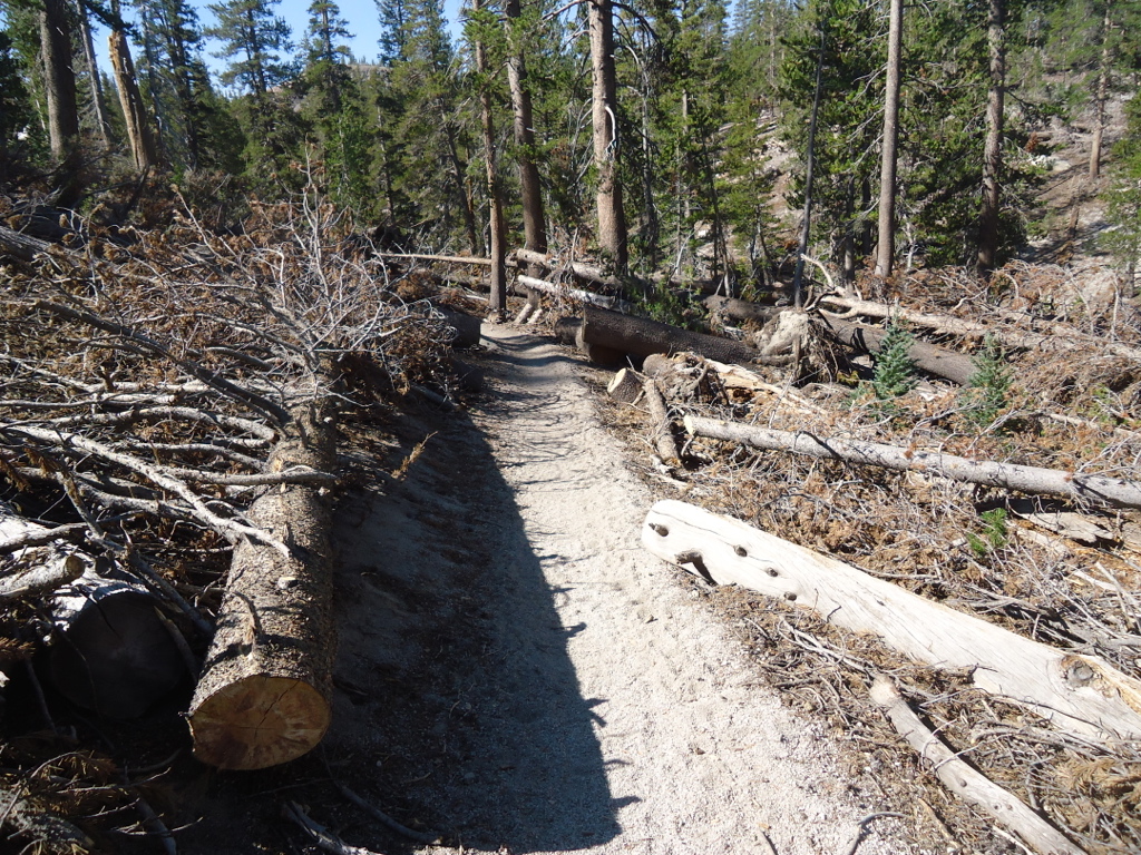
The next day I walked into unbelievable forest devastation. In November of 2011 an unusual wind storm blew down tens of thousands of trees around the Devil’s Postpile area. Huge trees were scattered in an almost whimsical pattern for a stretch of over ten miles.
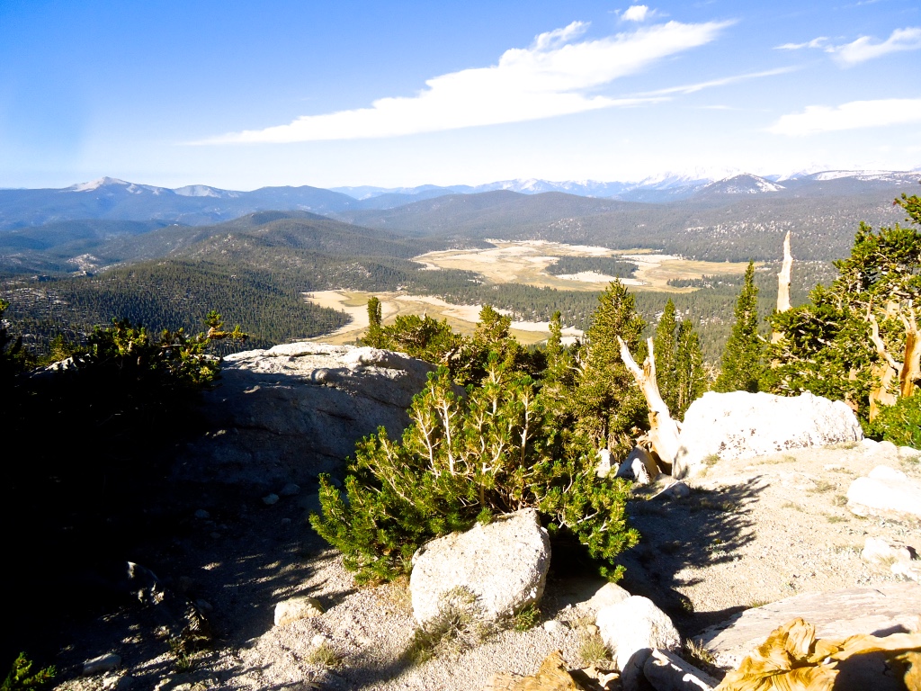
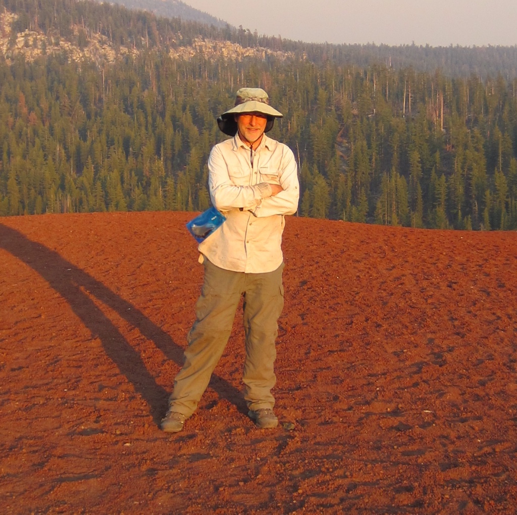
Shortly thereafter I climbed the northernmost Red Cone near Mammoth Mountain and attempted to find a place to camp. But it was like trying to camp on a huge billiard ball. Everything would roll off. The view was superlative but there was no safe place to pitch a tent.
I was now two days ahead of schedule and my reservation for a cabin at Red’s was two days away. So I camped that evening at the National Monument public campground. I found a nice spot, dropped my pack, and went looking for the pay station. I found the camp host who said I shouldn’t even bother to pay since it was so late in the season and I was a JMT walker. He warned me to be gone by 10AM the next day when the new camp host would take over. Evidently she was not as forgiving as this guy. I set up my tent and walked the 200 yards back to the cafe at Red’s Meadow for some dinner of wonderful non-dehydrated food. I recognized the same waitress Cindy and I had when we were here over Memorial Day 2013 for a late season ski trip.
When I returned to my campsite it was just about dusk and about five or six JMT walkers arrived in the campground. They obviously had the same idea as I did: find a free place to camp. By then the campground was almost full and they all migrated over to my spot asking if they could join me. I told them they were all welcome and we ended up with about eight people. They were from Portland, San Francisco, and elsewhere. Great bunch of hikers. We were all gone by the time the evil camp host arrived at 10AM the next morning.
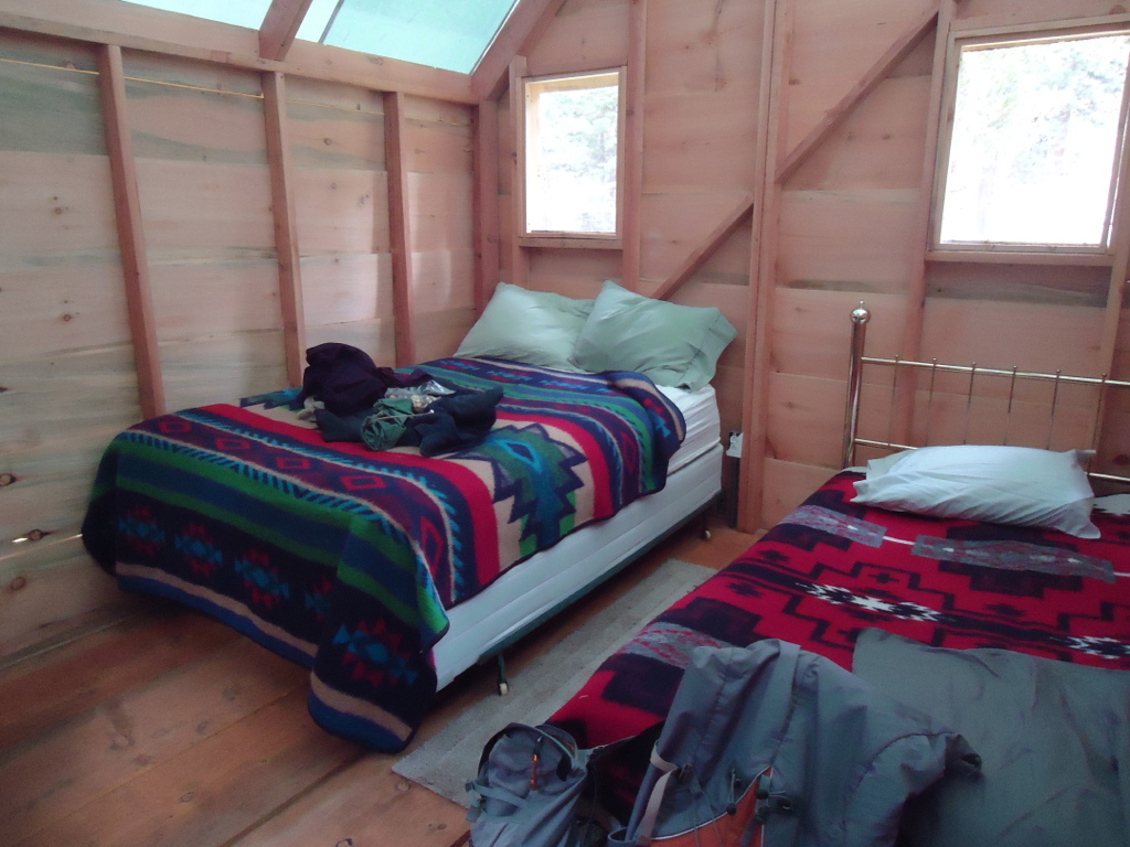
The next day, September 10th, I checked into my two-bedroom cabin at Red’s Meadow for two wonderful nights on a real bed.
Red’s Meadow Resort has a pay phone and the line would get pretty long at times. I would call Cindy after my dinner at the Mule House Cafe and rack up a ridiculous bill. Can you believe a $25 phone call?
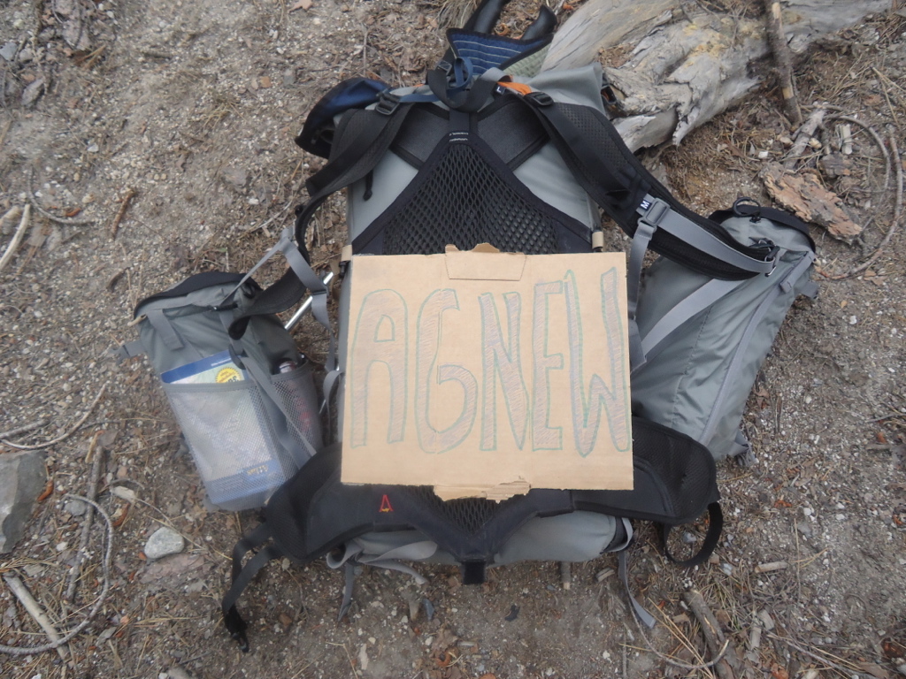
So on September 12th, day 29, I decided to forego the JMT via Shadow and Garnet Lakes in favor of the high trail above Agnew Meadows. The high trail follows the middle fork of the San Joaquin, perched high up along the steep canyon wall. Almost completely devoid of trees, the views are superb and unobstructed. It has always been one of my favorite walks, one that my father and I enjoyed.
I arrived at Thousand Island Lake early in the afternoon and had a difficult time finding a place to camp since most of the spots were taken.
So as not to retrace my steps, the next morning I hiked cross-country due north to catch the JMT near Island Pass. The weather was beginning to cool and clouds began to roll in over the crest. Looks like rain.
Chapter 11-Yosemite
Island Pass isn’t much of a pass. Just a low spot between the San Joaquin and the June Lake drainage. Still, it is a beautiful walk, especially as you approach Donahue Pass.
On the way down Donahue to Lyell Canyon I came across two interesting people. The first was a man who was intently looking at something in the trees with his binoculars. I approached him quietly, not wanting to spook his target.
“What do you see?” I asked.
“Pine marten. They’re pretty reclusive.”
I never did see what he was looking at, but I remember the only time I did see a marten years ago. It was above Lake George at Mammoth Lakes. He came down a long branch about ten feet off the ground and began to chastise me for invading his territory. They look like weasels with long tails and serious attitudes.
The second hiker I met was a solo Black woman laboring up the pass with a huge pack. She was hoping to make it over Donahue before dinner. At three in the afternoon, five miles to the pass, and almost 1500 vertical to climb, she was never going to make it. I suggested Marmot Lake just below the pass as an alternative. I hope she made it.
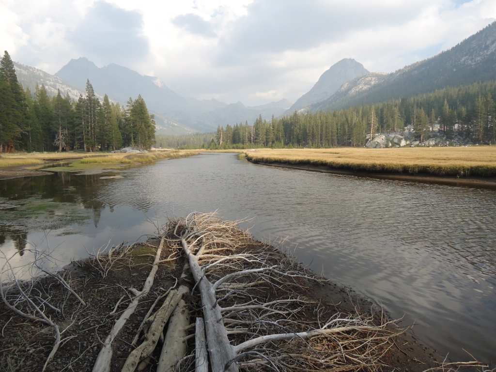
I was feeling very strong by now and I decided to go as far as Ireland Creek, a walk of about 17 miles total for the day. The day was becoming increasingly cold with large cumulus clouds building up on the crest. Not a good sign. I arrived at the junction of the Ireland Creek trail and the JMT about 4PM. I began to look for the campsite I had used a few years earlier with my friends Jerry and Mike. It was right on Ireland Creek with great places to set up a tent and fish. As I approached Ireland Creek I noticed that the NPS had rerouted a large portion of the JMT from the huge Lyell Canyon meadows up to the sides of the canyon. With years of heavy use, the JMT through this canyon had carved a two foot deep track in the meadow. Good call NPS. But as I arrived at Ireland Creek, the rerouting process had taken the JMT right through my favorite campsite! It had been decimated. Time to find a new spot. I was definitely bummed. I had a difficult time finding any privacy at all and settled on a spot near Lyell Creek. I set up camp, took a river bath, and set my laundry out to dry. In the space of about 30 minutes, the temperature dropped ten degrees and the sky became black. Right in the middle of my dinner it began to hail! Lightning and deafening thunder forced me back into my tent. I thought I was through with rain after the first few days of the trip! But hey, it is the Sierra and you have to expect anything. The storm deposited about an inch of hail and rumbled on through the night. By morning everything had melted and the temperature was close to freezing. The brilliant morning sun caused the water soaked meadows to steam with fog over ten feet high. An amazing sight. The frozen ground crackled under my feet.
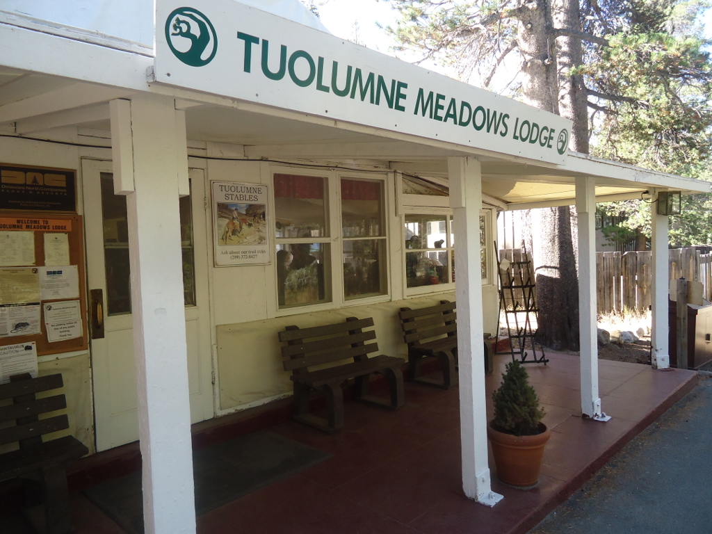
I arrived at Tuolumne Meadows Lodge in good spirits and checked in! There was plenty of room. I unloaded my pack and set my wet tent out to dry. Then off to the P.O. via the shuttle, which was also slated to shut down the next day. Good thing I was ahead of schedule, everything would have been closed down and I never would have gotten my resupply food. Or so I thought. Evidently the rationale for shutting everything down early was due to the Tioga Pass road closure and lack of business. I patiently stood in line at the P.O. for my food package. I was informed that due to the closure they had sent all packages to the valley! No food! The clerk had sent my package off only an hour earlier! I just missed it! I was not happy. At least they could have had the NPS handle the packages since the campgrounds were still open for another two weeks! And when I originally sent the cache to them, they said they would be open until the end of September. They should have known that a good number of PCT and JMT people would be very upset about not getting their food. And they never even bothered to inform anyone. Dogs. Later on I found out that my food never really made it to the valley. They sent it back to Walnut! Cindy couldn’t figure out why my food package suddenly returned after being sent over two months ago.
I stood in stunned silence for a moment trying to formulate a plan. The kind clerk suggested two options: take the shuttle down to Lee Vining and stock up or go next door to the Tuolumne Meadows store. I opted for the store. Bad idea. Obviously, other people had been inconvenienced by the P.O. and were cleaning out the shelves. And to make matters worse, they were blowing everything out at 50% off. Faced with a sudden mandate to close the store, they needed to liquidate all their stock. The shelves were absolutely bare, only a few things remaining. Most of which I refused to eat. Beef jerky, rank looking trail mix. The only thing left was Ramen. So here was the dilemma: eat Ramen for the next five days or go to Lee Vining. I reluctantly decided on Ramen.
Well, at least the Tuolumne Meadows Grill was open, so I mowed down a bunch of carbs for lunch in hopes of staving off my upcoming Ramen death march. After lunch I headed back to the Tuolumne Meadows Lodge for a shower and laundry. Dinner that night was wonderful, where everyone ate family style. Great people, including the couple I had met on the trail, and great food. I was kind of a rock star figure to my fellow tablemates, everyone very interested in my JMT walk.
The next day, Sunday September 15th, I enjoyed my final TML breakfast and took the shuttle to the Tuolumne Meadows Campground, right next to the store and grill. Sunday was the last day for everything at Tuolumne except the campground. So I had another huge lunch at the grill and found a beautiful spot in the campground. I pitched my tent right next to some climbers who were planning on climbing Cathedral Peak. After lunch at the grill I stopped by the sport shop to see if the had any blowout deals. Kind of crazy since I would have to carry anything I might purchase. The shop was empty and the clerk was playing the “Heavy Weather” album by Weather Report. One of my favorites. I made a comment to the man behind the counter about his choice of music and we then chatted for almost an hour about music. That evening I attended a campfire program put on by the NPS staff.
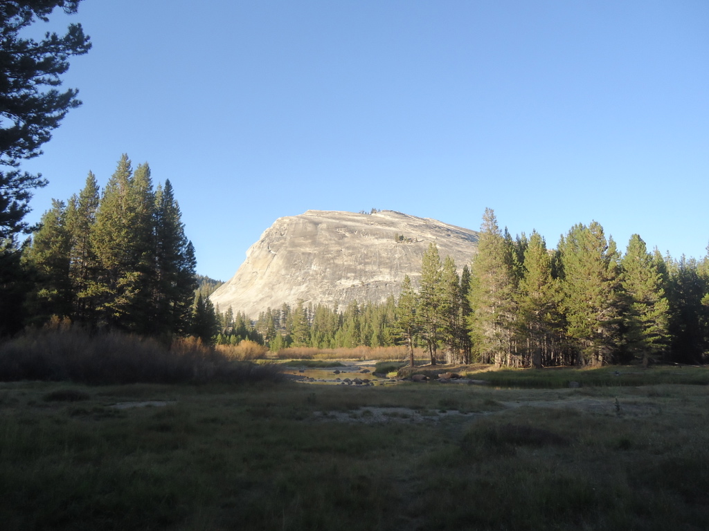
The following day I climbed Lembert Dome in heavy winds and later took a wonderful ranger-led walk through the meadows.
That night the temperature dropped into the low 20s and my platypus water bottle froze solid. That’s two liters! It was by far the coldest night so far and my bag was at its comfort limit, even with all my long underwear! In the morning all four of us stood in the direct rays of the sun like big thermal sponges. If I only could have had a fire!
The next day I hit the trail early in anticipation of finally getting to backpackers’ camp at the foot of Half Dome.
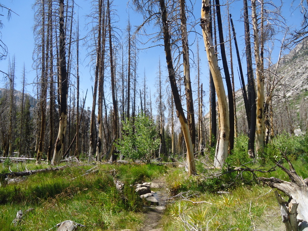
The trail from Sunrise Camp down to Little Yosemite Valley was steep and not graded well. Good thing I was going downhill. I saw a number of people laboring up the hill at a snail’s pace. Sunrise Creek was completely dry and a large section of forest had been burned long ago. I met a couple that had been plagued by a persistent bear near Sunrise Creek. Arriving at backpackers’ camp was like seeing an old friend. I had camped there many times before and I headed for my favorite spot. Unfortunately, it was taken. But the strangest thing happened everyday there. In the afternoon the camp would gradually fill with backpackers from the valley floor, some carrying the most ridiculous array of stuff I had ever seen a backpacker carry! People had carried big coolers, cases of beer, canned food, chairs, huge tents, and easy-ups! Not exactly ultralight. These guys were all from the valley and were going to ascend Half Dome the next day. The walk from the valley floor to backpackers’ camp is only about 4.5 miles and a few thousand feet of vertical. This explains how hikers could get away with hauling such crazy stuff. Then very early the next day the camp would empty as everyone headed out to conquer Half Dome, leaving all their gear behind. It was like a ghost town. One day I was the only person in camp where earlier there had been more than 75 people. Then in the early afternoon the intrepid hikers would return, collect their gear, and head back to the valley as the next wave of hikers came charging up the hill. I met a number of very interesting people.
Thankfully the temperature was substantially warmer at backpackers’ camp, being at 6100 feet as opposed to 9300 feet at Sunrise. So I resigned myself to explore the area over the next three days and eat my Ramen. On my second day in camp I got to know a father and son from Santa Rosa. They were friendly and woefully overpacked with gear and food for just a one-nighter. When they learned of my Ramen dilemma they were more than happy to give me anything I wanted. I sadly couldn’t eat a lot of their meat based meals but I did take a few. As a vegetarian, eating any amount of meat sets my digestive tract off now, so I have to be careful. Still, it was a nice departure from Ramen.
Over the next three days I became more and more anxious to get on the trail. It was such a mixed feeling. I had become such a part of the wilderness that I felt very at home in the backcountry, yet I missed my family terribly. I really didn’t want to finish my epic walk, but I hadn’t seen my extended family in over five weeks. To pass the time I walked up the Merced River towards Merced Lake, explored Lost Lake and searched for the trail to Snake Dike. I took lots of photos, did laundry, and swam in the barely moving Merced. And I had nothing to read! I purposely didn’t bring any reading material due to the weight. What a bad idea! A backpack is the time to take on the heavyweights like Also Sprach Zarathustra or Crime and Punishment! I’ll never make that mistake again.
Climbing Half Dome now requires a permit, which I didn’t have. I was hoping to tag along with a group who might have an extra spot. But no luck. So I never got to climb it! On my way down to the valley I came across a few people who said they had climbed it without a permit. The trick was to get to the bottom of the cables before the ranger gets there and starts checking permits! If I had only known.
Finally after three days of waiting and watching all the hikers come and go, I headed down the trail to Happy Isles where Cindy would be waiting. It was September 21st, day 38, as I left backpackers’ camp with no Ramen or trail mix remaining in my pack. I was definitely below 20 pounds now. I started early and took a very leisurely pace, taking photos and stopping to observe all that I could. The temperature began to drop and clouds filled the valley. Snow began to fall on Half Dome. What a perfect finish to a marvelous adventure! Both Vernal and Nevada Falls were barely running.
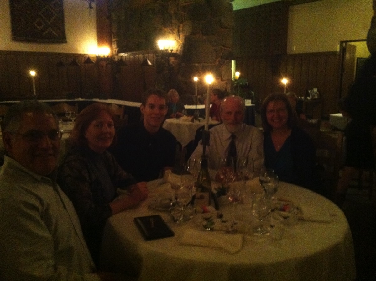
We took the shuttle back to Yosemite Lodge as a light rain started to fall. Cindy informed me that my backpacking buddy and friend of forty years, Mike Lamka, had come to the valley to meet me too, along with his wife and son. What a wonderful surprise. Cindy and I had reservations at the Yosemite Lodge for two nights, September 21st and 22nd. That evening we went to the bar before dinner where I had a very large and delicious beer as we watched the rain fall. But I really was looking forward to fruit and vegetables. Then on Sunday night we had dinner with Mike and Lynn Lamka at the Ahwahnee, wearing suits and ties and fancy dresses.
Chapter 12-Epilogue
Looking back on this adventure now, it all seems so distant, almost like a dream. It was an alternate reality so different from our insulated, hectic city lives. How many of us have had the chance to be alone for such an extended period of time? The internal dialog that develops over the course of such a trip is something most people never experience. With all the superfluous nonsense of everyday life stripped away, there was time to evaluate my life, remember the past, honor the lives of loved ones long passed away, and reaffirm the commitment to be the best person possible. On many occasions I thought of people and events in the distant past that I had almost forgotten. It was wonderful to keep those memories alive. It is very difficult to explain the almost transcendental quality of this kind of experience. Reentry into the non-wilderness world was a bit of a shock. Everything was so rushed. Everything was so loud!
Of course, the best part of any return is the people. I can’t thank my family enough for the support and good wishes, not to mention Jerry for the resupply package and brandy! I was touched that so many people followed my progress on the Spot Gen 3 website as I walked my 230 miles, as well as the kindness and concern shown by Mike and Lynn Lamka.
I often sit down and look at the over 500 photos and hours of video I shot. It seems like a different person hiked those miles. Since my 2013 journey I have taken a number of much shorter backpacks with my friends but the experience is not quite the same. When you are alone for so long and walk so far, things are different. I know that I am certainly different after an experience like this. Make no mistake, the JMT is a very strenuous hike, but when Cindy asked me if I would do it again, I answered “yes” in a second. I know what John Muir meant when he said, “The mountains are calling and I must go.”
THE END